
IMAGES TAKEN NEAR TO
Litherland Close, CHIPPENHAM, SN14 0FH
Introduction
This page details the photographs taken nearby to Litherland Close, SN14 0FH by members of the Geograph project.
The Geograph project started in 2005 with the aim of publishing, organising and preserving representative images for every square kilometre of Great Britain, Ireland and the Isle of Man.

There are currently over 7.5m images from over14,400 individuals and you can help contribute to the project by visiting https://www.geograph.org.uk
Image Map
Images are licensed for reuse under creativecommons.org/licenses/by-sa/2.0
Notes
- Clicking on the map will re-center to the selected point.
- The higher the marker number, the further away the image location is from the centre of the postcode.
Image Listing (31 Images Found)
Images are licensed for reuse under creativecommons.org/licenses/by-sa/2.0
Image
Details
Distance
1
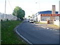
Bath Road Industrial Estate
This unnamed road leads from Bath Road, A4, to the estate.
Image: © Michael Dibb
Taken: 22 Apr 2017
0.08 miles
2
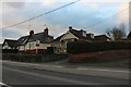
Bungalows on Bath Road, Chippenham
It's Bath Road from Hounslow and I completed the run from Corsham back to there and beyond on the way back.
Image: © David Howard
Taken: 4 Jan 2020
0.10 miles
3
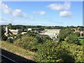
From a Swindon-Bristol train, Bath Road Industrial Estate, Chippenham
Image: © Nigel Thompson
Taken: 12 Sep 2017
0.11 miles
4
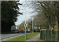
2009 : Looking north on Hungerdown Lane, Chippenham
Part of Chippenham's partial inner ring road with a timely warning to drivers with lead in their shoes.
Image: © Maurice Pullin
Taken: 16 Feb 2009
0.11 miles
5
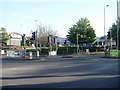
A plethora of street furniture
All this street furniture is at the entrance to a retail park containing some of the usual suspects.
Image: © Michael Dibb
Taken: 22 Apr 2017
0.11 miles
6
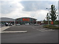
DIY Store, Chippenham
A view looking to the southwest over the carpark of the new retail park in the hungerdown area of Chippenham. As of June 2006, this building, and others on the site, are not marked on the OS map. The main London-Bristol rail line runs to the left of the image, with the A4 road on the right.
Image: © Phil Williams
Taken: 27 Jun 2006
0.13 miles
7
![Tunnel under the railway [1]](https://s3.geograph.org.uk/geophotos/05/36/54/5365463_f035d657_120x120.jpg)
Tunnel under the railway [1]
A pedestrian tunnel has been constructed alongside the bridge carrying the railway over Bath Road, A4. This view is looking west.
Image: © Michael Dibb
Taken: 22 Apr 2017
0.13 miles
8
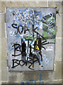
Make of it what you will
Some local colour on a box in the wall at the entrance of the subway.
Image: © Neil Owen
Taken: 29 Feb 2012
0.13 miles
9
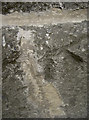
Rivet in the railway bridge
A survey rivet in the substantial stonework of the railway bridge on the A4 Bath Road. This benchmark is listed in the Benchmark Database: http://www.bench-marks.org.uk/bm19690 , and perhaps replaces an earlier mark. See Image] for a wider view.
Image: © Neil Owen
Taken: 29 Feb 2012
0.13 miles
10
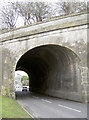
Railway bridge over the A4 in Chippenham
The sturdy and rather lofty bridge carrying the trains to and from the town's station. It has to be, judging by the number of vehicular impacts and scrapes that bear witness - see Image A benchmark rivet can still be seen on the left-hand support - Image
Image: © Neil Owen
Taken: 29 Feb 2012
0.14 miles