
IMAGES TAKEN NEAR TO
Clifton Street, SWINDON, SN1 3PZ
Introduction
This page details the photographs taken nearby to Clifton Street, SN1 3PZ by members of the Geograph project.
The Geograph project started in 2005 with the aim of publishing, organising and preserving representative images for every square kilometre of Great Britain, Ireland and the Isle of Man.

There are currently over 7.5m images from over14,400 individuals and you can help contribute to the project by visiting https://www.geograph.org.uk
Image Map
Images are licensed for reuse under creativecommons.org/licenses/by-sa/2.0
Notes
- Clicking on the map will re-center to the selected point.
- The higher the marker number, the further away the image location is from the centre of the postcode.
Image Listing (84 Images Found)
Images are licensed for reuse under creativecommons.org/licenses/by-sa/2.0
Image
Details
Distance
1
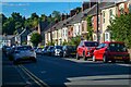
Swindon : Clifton Street
Looking off Kingshill Road.
Image: © Lewis Clarke
Taken: 14 Jul 2022
0.02 miles
2
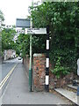
Direction Sign ? Signpost on the A4289 in Swindon
Located on the northwest side of the junction of the A4289 Kingshill Road and Clifton Street, Central Swindon South parish. 1 arm and missing finial. The arm cannot be seen on Google Earth in 2020. See also https://www.geograph.org.uk/photo/1099246 and https://www.geograph.org.uk/photo/1099250
Milestone Society National ID: WI_SU1483B
Image: © John V Nicholls
Taken: 28 Jun 2009
0.03 miles
3

Clifton Street, Swindon
Clifton Street is in the foreground. The street is residential and is characterized by substantial Victorian and Edwardian terraced houses. The road in the background is the A4289, better known locally as Kingshill Road. The road sign at the centre right is the 'pre-Worboys' sign seen in this image http://www.geograph.org.uk/photo/1099246
Image: © Brian Robert Marshall
Taken: 31 Dec 2008
0.03 miles
4
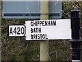
Close-up, old road sign, Clifton Street, Swindon
This is a closer view of the 'pre-Worboys' road sign in this image http://www.geograph.org.uk/photo/1099246
Image: © Brian Robert Marshall
Taken: 31 Dec 2008
0.03 miles
5
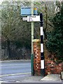
Old road sign, Clifton Street, Swindon
I believe the term for these signs is 'pre-Worboys'. The sign is in quite good condition and hasn't had its road number indicator removed as others have elsewhere. This is perhaps an oversight as the main road, Kingshill Road visible behind the sign, is now the A4289. There is a closer look at the sign here http://www.geograph.org.uk/photo/1099250
Image: © Brian Robert Marshall
Taken: 31 Dec 2008
0.03 miles
6
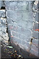
Benchmark at wall junction of Kingshill Road
Ordnance Survey cut mark benchmark described on the Bench Mark Database at http://www.bench-marks.org.uk/bm40445
Image: © Roger Templeman
Taken: 5 Jan 2012
0.04 miles
7
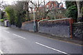
Wall on SW side of Kingshill Road
There is an OS benchmark Image at the junction of the brick and stone sections of the wall where ivy overhangs it.
Image: © Roger Templeman
Taken: 5 Jan 2012
0.04 miles
8
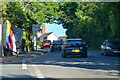
Swindon : Kingshill Road A4289
Looking along the road.
Image: © Lewis Clarke
Taken: 14 Jul 2022
0.05 miles
9
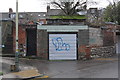
Garage and rear access road, Kingshill Road
There is an OS benchmark Image on the wall angle to the right of the garage door.
Image: © Roger Templeman
Taken: 5 Jan 2012
0.05 miles
10
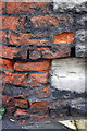
Weathered benchmark on wall opposite #106 Kingshill Road
Ordnance Survey cut mark benchmark described on the Bench Mark Database at http://www.bench-marks.org.uk/bm25591
Image: © Roger Templeman
Taken: 5 Jan 2012
0.05 miles