
IMAGES TAKEN NEAR TO
Shelley Street, SWINDON, SN1 3PW
Introduction
This page details the photographs taken nearby to Shelley Street, SN1 3PW by members of the Geograph project.
The Geograph project started in 2005 with the aim of publishing, organising and preserving representative images for every square kilometre of Great Britain, Ireland and the Isle of Man.

There are currently over 7.5m images from over14,400 individuals and you can help contribute to the project by visiting https://www.geograph.org.uk
Image Map
Images are licensed for reuse under creativecommons.org/licenses/by-sa/2.0
Notes
- Clicking on the map will re-center to the selected point.
- The higher the marker number, the further away the image location is from the centre of the postcode.
Image Listing (164 Images Found)
Images are licensed for reuse under creativecommons.org/licenses/by-sa/2.0
Image
Details
Distance
1
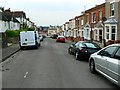
Shelley Street, Swindon
The street is a cul de sac with its termination behind the viewpoint. The properties on the right are either Victorian or Edwardian while those on the left are between-the-wars.
Image: © Brian Robert Marshall
Taken: 16 Sep 2008
0.02 miles
2
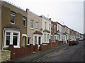
Swindon: Shelley Street
Unusual low decorative railings adorn the parapets of the front facades of these otherwise unremarkable Victorian terraced houses.
Image: © Nigel Cox
Taken: 26 Oct 2007
0.04 miles
3
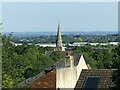
View from Radnor Street Cemetery
The spire is that of St Mark’s, the railway village church https://www.geograph.org.uk/photo/4392655 .
Image: © Alan Murray-Rust
Taken: 14 Jul 2022
0.04 miles
4
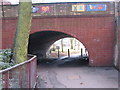
Canal Walk Swindon
The Wilts and Berks canal once flowed through here, right through what is now the main shopping area behind the camera
Image: © Peter Watkins
Taken: 21 Jan 2006
0.05 miles
5
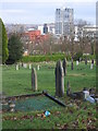
Swindon from Kingshill cemetery
A good viewpoint over Swindon in winter
Image: © Peter Watkins
Taken: 21 Jan 2006
0.05 miles
6
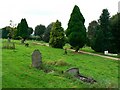
Radnor Street cemetery, Swindon
The cemetery opened for business in 1881 when it received its first customer. It was started when the graveyard at the nearby St Mark's church was approaching capacity. Interments ceased in the 1970s and it is now a local nature reserve.
Image: © Brian Robert Marshall
Taken: 16 Sep 2008
0.06 miles
7
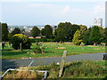
Central Swindon from Radnor Street cemetery
The iconic David Murray John Tower can be seen at the right Image
Image: © Brian Robert Marshall
Taken: 19 Sep 2009
0.06 miles
8
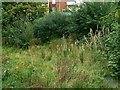
A hole in the ground, Shelley Street, Swindon
This piece of unprepossessing land at the end of Shelley Street and behind Deacon Street (in the background) has been a source of trouble for years. The original Victorian developers of the locality were unable to do anything with it and successive prospective entrepreneurs have so far failed to make any headway. The reasons are primarily geological as I recall. The most recent proposal was to build 21 flats and that was refused this year on grounds [npi] that included inadequate measures to deal with known instability. The planning application details are here http://194.73.99.13/publicaccess/tdc/DcApplication/application_detailview.aspx?caseno=JYSXG1PT04W00
Image: © Brian Robert Marshall
Taken: 16 Sep 2008
0.07 miles
9
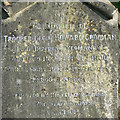
Inscription on memorial to Trooper Goodman, Radnor Street cemetery, Swindon
Trooper Goodman died on the eleventh day of the eleventh month 1900, a date that would become famous eighteen years later with the cessation of hostilities in the Great War. The soldier was a clerk with the Great Western Railway before taking up arms and must have been highly regarded by his peers at the railway who provided this fine memorial to him Image
Image: © Brian Robert Marshall
Taken: 19 Sep 2009
0.08 miles
10
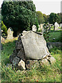
Memorial to Trooper Goodman, Radnor Street cemetery, Swindon
The memorial was designed to replicate a typical battlefield grave. It commemorates the death of Trooper Cecil Howard Goodman who died in the Boer War in 1900 and whose remains lie in South Africa still. The inscription can be seen here Image
Image: © Brian Robert Marshall
Taken: 19 Sep 2009
0.08 miles