
IMAGES TAKEN NEAR TO
Stafford Street, SWINDON, SN1 3PQ
Introduction
This page details the photographs taken nearby to Stafford Street, SN1 3PQ by members of the Geograph project.
The Geograph project started in 2005 with the aim of publishing, organising and preserving representative images for every square kilometre of Great Britain, Ireland and the Isle of Man.

There are currently over 7.5m images from over14,400 individuals and you can help contribute to the project by visiting https://www.geograph.org.uk
Image Map
Images are licensed for reuse under creativecommons.org/licenses/by-sa/2.0
Notes
- Clicking on the map will re-center to the selected point.
- The higher the marker number, the further away the image location is from the centre of the postcode.
Image Listing (133 Images Found)
Images are licensed for reuse under creativecommons.org/licenses/by-sa/2.0
Image
Details
Distance
1
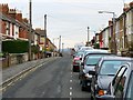
Stafford Street, Swindon
Stafford Street is late Victorian. It was developed in a time of considerable expansion following the establishment of the Great Western Railway factory in the mid 19th century.
Image: © Brian Robert Marshall
Taken: 1 Dec 2008
0.01 miles
2
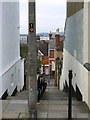
Steps from Stafford Street to Dixon Street, Swindon
The steps provide a short-cut between the two, quite long, streets of Victorian houses. The area lies on the hill to the south of what was once called New Town and Old Town, an appellation that persists.
Image: © Brian Robert Marshall
Taken: 1 Dec 2008
0.04 miles
3
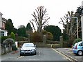
The western end of Stafford Street, Swindon
The road ends at the boundary of the cemetery seen in this image http://www.geograph.org.uk/photo/965694
Image: © Brian Robert Marshall
Taken: 1 Dec 2008
0.05 miles
4
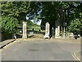
Radnor Street Cemetery gates
This is the Dixon Street/Deacon Street entrance.
Image: © Alan Murray-Rust
Taken: 14 Jul 2022
0.06 miles
5
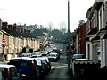
A view along Deacon Street, Swindon
This is just one of many streets built in the years following Brunel's decision to build a huge railway works in Swindon in the mid 19th century. Deacon Street is one of a grid of very similar streets that connect the 'Old Town' on a hill to the south-east of the viewpoint, and the 'New Town' of which the grid is part. The green area in the centre of the image is Radnor Street cemetery. Image
Image: © Brian Robert Marshall
Taken: 26 Mar 2007
0.08 miles
6
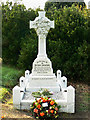
The grave of Esther Swinford, Radnor Street cemetery, Swindon
Poor Esther was a barmaid at a public house not far from here. She met a tragic end by being shot to death by her former fiancé at the tender age of 19 106 years ago yesterday. Her killer was one Edward Richard Palmer, aged 24. He was 'convicted at Wiltshire Assizes before Mr Justice Wills of the murder of Esther Swinford at Swindon. Miss Swinford was employed as a barmaid and had been engaged to Palmer. She had broken off their intended union when she discovered that he had made no plans to secure their financial future. Palmer left town but later returned with a gun and shot her through the heart when she refused to reconsider their engagement. He was immediately arrested and told officers: 'I did it. I loved her.' Hanged by William and John Billington on the 17th November 1903 in Devizes.' From real-crime.co.uk The inscription can be read here Image The pub where the murder took place can be seen in this image Image
Image: © Brian Robert Marshall
Taken: 19 Sep 2009
0.08 miles
7
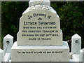
Inscription on the grave of Esther Swinford, Radnor Street cemetery, Swindon
The grave has very recently been restored having been derelict for many years. This is the state the grave was in http://www.flickr.com/photos/swindonlocal/3774096439/in/set-72157621757273407/
Image: © Brian Robert Marshall
Taken: 19 Sep 2009
0.08 miles
8
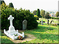
Radnor Street cemetery, Swindon
In the left foreground is the recently-restored grave of a murder victim named Esther Swinford Image The cemetery itself dates from the mid 19th century and is no longer used for burials. The church spire just visible on the right horizon is St Mark's church Image
Image: © Brian Robert Marshall
Taken: 19 Sep 2009
0.09 miles
9
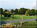
Central Swindon from Radnor Street cemetery
The iconic David Murray John Tower can be seen at the right Image
Image: © Brian Robert Marshall
Taken: 19 Sep 2009
0.09 miles
10
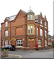
Former pub in Hythe Road
I must have passed this former pub many times in my youth, but its name escapes me. It stands on the corner of Hythe Road and Maidstone Road in an area that was developed around 1900 as Old Town gradually crept down the hill towards the ever expanding New Town below. It now appears to be apartments.
Image: © Gordon Hatton
Taken: 23 May 2017
0.10 miles