
IMAGES TAKEN NEAR TO
Dixon Street, SWINDON, SN1 3PJ
Introduction
This page details the photographs taken nearby to Dixon Street, SN1 3PJ by members of the Geograph project.
The Geograph project started in 2005 with the aim of publishing, organising and preserving representative images for every square kilometre of Great Britain, Ireland and the Isle of Man.

There are currently over 7.5m images from over14,400 individuals and you can help contribute to the project by visiting https://www.geograph.org.uk
Image Map
Images are licensed for reuse under creativecommons.org/licenses/by-sa/2.0
Notes
- Clicking on the map will re-center to the selected point.
- The higher the marker number, the further away the image location is from the centre of the postcode.
Image Listing (223 Images Found)
Images are licensed for reuse under creativecommons.org/licenses/by-sa/2.0
Image
Details
Distance
1
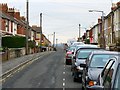
Stafford Street, Swindon
Stafford Street is late Victorian. It was developed in a time of considerable expansion following the establishment of the Great Western Railway factory in the mid 19th century.
Image: © Brian Robert Marshall
Taken: 1 Dec 2008
0.05 miles
2
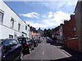
Looking south-southwest up Stanier Street
Image: © Basher Eyre
Taken: 14 Jul 2022
0.07 miles
3
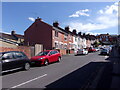
Looking south-southwest up Newhall Street
Image: © Basher Eyre
Taken: 14 Jul 2022
0.07 miles
4
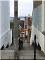
Steps from Stafford Street to Dixon Street, Swindon
The steps provide a short-cut between the two, quite long, streets of Victorian houses. The area lies on the hill to the south of what was once called New Town and Old Town, an appellation that persists.
Image: © Brian Robert Marshall
Taken: 1 Dec 2008
0.08 miles
5
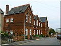
Former Gilberts Hill school, Dixon Street, Swindon
The school was built in 1880 and closed as late as 2000. It was converted into flats two years later. http://archive.wiltshiretimes.co.uk/2003/7/3/151528.html In the background at the right is the late unlamented 1960s Swindon College building, now empty and awaiting demolition.
Image: © Brian Robert Marshall
Taken: 16 Sep 2008
0.09 miles
6
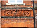
Panel (1 of 3), former Gilberts Hill school, Dixon Street, Swindon
The panel is on the front elevation of the former school which has been converted for residential use and is the leftmost of three. The inscription on the left appears to be the name of the architect but I can't make much sense of it other than the letters 'ARIBO'.
Image: © Brian Robert Marshall
Taken: 16 Sep 2008
0.09 miles
7
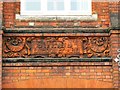
Panel (2 of 3), former Gilberts Hill school, Dixon Street, Swindon
This is the centre panel on the front elevation of the building. The former school was erected in 1880 by the Swindon School Board. This pre-dates the establishment of local government in the form we have today. Swindon didn't have a unified council until 1900 and County councils didn't arrive until later in the 1800s.
Image: © Brian Robert Marshall
Taken: 16 Sep 2008
0.09 miles
8
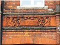
Panel (3 of 3), former Gilberts Hill school, Dixon Street, Swindon
This is the right-hand of three panels and commemorates the enlargement of the original 1880 building. The inscription at the right says in a mix of upper and lower case 'SELMES sculpt.'. The school closed in 2000 and was converted two years later into flats.
Image: © Brian Robert Marshall
Taken: 16 Sep 2008
0.09 miles
9

Crossroads of Crombey and Newhall Streets
Image: © Basher Eyre
Taken: 14 Jul 2022
0.09 miles
10
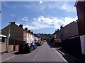
Looking south-southwest up Morse Street
Image: © Basher Eyre
Taken: 14 Jul 2022
0.10 miles