
IMAGES TAKEN NEAR TO
Lansdown Road, SWINDON, SN1 3NF
Introduction
This page details the photographs taken nearby to Lansdown Road, SN1 3NF by members of the Geograph project.
The Geograph project started in 2005 with the aim of publishing, organising and preserving representative images for every square kilometre of Great Britain, Ireland and the Isle of Man.

There are currently over 7.5m images from over14,400 individuals and you can help contribute to the project by visiting https://www.geograph.org.uk
Image Map
Images are licensed for reuse under creativecommons.org/licenses/by-sa/2.0
Notes
- Clicking on the map will re-center to the selected point.
- The higher the marker number, the further away the image location is from the centre of the postcode.
Image Listing (94 Images Found)
Images are licensed for reuse under creativecommons.org/licenses/by-sa/2.0
Image
Details
Distance
1
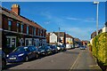
Swindon : Lansdown Road
Looking along Lansdown Road.
Image: © Lewis Clarke
Taken: 14 Jul 2022
0.00 miles
2
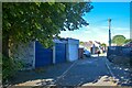
Swindon : Alleyway
An alley off Kent Road.
Image: © Lewis Clarke
Taken: 14 Jul 2022
0.03 miles
3
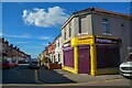
Swindon : Hythe Road
Looking along Hythe Road with the Premier Express store on the corner.
Image: © Lewis Clarke
Taken: 14 Jul 2022
0.04 miles
4
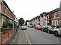
Kent Road
An area of red brick terraced housing towards the western end of the 'old town' hill and developed circa 1890-1910. The photo shows two typical styles of Swindon housing, the type with the small ground floor bay window, which is very common throughout the town and the superior style with two bay windows under a gable front. The Kent Road area was developed by John Henry Harding Sheppard, a brewer, who owned land near the railway station [note streets in that area named after him]. Following his retirement to Kent, he developed a greenfield site here and named all the streets after Kentish locations.
Image: © Gordon Hatton
Taken: 23 May 2017
0.04 miles
5
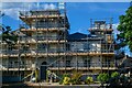
Swindon : Kingshill House
A villa, now a clinic and is Grade II listed.
Image: © Lewis Clarke
Taken: 14 Jul 2022
0.06 miles
6
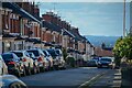
Swindon : Kent Road
Looking along Kent Road.
Image: © Lewis Clarke
Taken: 14 Jul 2022
0.06 miles
7
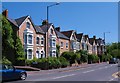
Bath Road, Swindon
Superior terraced houses of circa 1900 in the Old Town area of Swindon. In general, the higher the altitude in Swindon, the more expensive the housing, so houses for the factory workers were generally at the bottom of the hill and those for the managerial class were at the top.
Image: © Gordon Hatton
Taken: 3 Jun 2010
0.07 miles
8
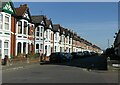
Kent Road, Swindon
Late 19th century development between the old and new towns
Image: © Alan Murray-Rust
Taken: 14 Jul 2022
0.07 miles
9
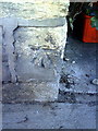
Benchmark on end of party wall between #82/84 Bath Road
Ordnance Survey cut mark benchmark described on the Bench Mark Database at http://www.bench-marks.org.uk/bm37360
Image: © Roger Templeman
Taken: 18 Mar 2011
0.07 miles
10
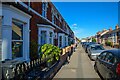
Swindon : Lansdown Road
Looking along Lansdown Road.
Image: © Lewis Clarke
Taken: 14 Jul 2022
0.07 miles