
IMAGES TAKEN NEAR TO
Newport Street, SWINDON, SN1 3DT
Introduction
This page details the photographs taken nearby to Newport Street, SN1 3DT by members of the Geograph project.
The Geograph project started in 2005 with the aim of publishing, organising and preserving representative images for every square kilometre of Great Britain, Ireland and the Isle of Man.

There are currently over 7.5m images from over14,400 individuals and you can help contribute to the project by visiting https://www.geograph.org.uk
Image Map
Images are licensed for reuse under creativecommons.org/licenses/by-sa/2.0
Notes
- Clicking on the map will re-center to the selected point.
- The higher the marker number, the further away the image location is from the centre of the postcode.
Image Listing (312 Images Found)
Images are licensed for reuse under creativecommons.org/licenses/by-sa/2.0
Image
Details
Distance
1
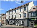
Emporium Court
Block of flats on Newport Street.
Image: © Ian Capper
Taken: 14 Jul 2022
0.00 miles
2
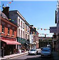
Wood Street
The main shopping street of Swindon's Old Town ought to be one lined with fashionable shops and specialist retailers, but like many other shopping streets it has its share of empty units. The attractive redbrick building on the left was once the town's best bookshop, whilst 4 doors further along was once Nash's sweet shop where one could linger whilst contemplating whether to spend pocket money on sherbet flying saucers or black jacks.
Image: © Gordon Hatton
Taken: 3 Jun 2010
0.01 miles
3
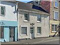
The Cottage
Cottage at 12 Newport Street.
Image: © Ian Capper
Taken: 14 Jul 2022
0.01 miles
4
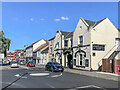
Newport Street
Looking along Newport Street with the Steam Railway Co pub on the right (see Image).
Image: © Ian Capper
Taken: 14 Jul 2022
0.02 miles
5
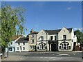
The Steam Railway Company, Swindon Old Town
There's a public house shown here on the 1900 map but this is probably not its original name.
Image: © Stephen Craven
Taken: 14 Jul 2022
0.02 miles
6
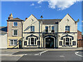
The Steam Railway Co
Pub on Newport Street. According to the Whatpub website, an inn called The White Hart was on this site in 1739, renamed The Bull c.1782. It was rebuilt in 1876 and renamed the Railway Hotel in 1881 (reflecting its proximity to the Midland and South Western Junction Railway's Swindon Town Station). It was then renamed the Old Town Tavern in 1976 before being given its current name in 1992.
Image: © Ian Capper
Taken: 14 Jul 2022
0.02 miles
7
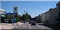
Newport Street
Newport Street is one of the four main thoroughfares of Swindon's Old Town. It was widened some 50 years ago with the demolition of some very poor terraced cottages. Some of the original buildings exist on the right hand side.
Image: © Gordon Hatton
Taken: 3 Jun 2010
0.03 miles
8
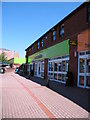
Co-op store, Newport Street
Co-op food store on the north side of Newport Street occupying a site that was once Skurrays Garage.
Image: © Gordon Hatton
Taken: 3 Jun 2010
0.03 miles
9
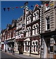
The Kings Hotel
Situated midway along Wood Street and only 200m or so from the Goddard Arms Hotel, which was its only rival for hotel business some 50 years ago when it was known as the Kings Arms. A fun building in a rather florid Victorian style.
Image: © Gordon Hatton
Taken: 3 Jun 2010
0.03 miles
10
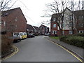
Dewell Mews, Swindon
This was the site of the livestock market, commemorated by a ram statue http://www.geograph.org.uk/photo/3851037 behind the camera.
Image: © Jaggery
Taken: 14 Apr 2013
0.04 miles