
IMAGES TAKEN NEAR TO
Victoria Road, SWINDON, SN1 3AL
Introduction
This page details the photographs taken nearby to Victoria Road, SN1 3AL by members of the Geograph project.
The Geograph project started in 2005 with the aim of publishing, organising and preserving representative images for every square kilometre of Great Britain, Ireland and the Isle of Man.

There are currently over 7.5m images from over14,400 individuals and you can help contribute to the project by visiting https://www.geograph.org.uk
Image Map
Images are licensed for reuse under creativecommons.org/licenses/by-sa/2.0
Notes
- Clicking on the map will re-center to the selected point.
- The higher the marker number, the further away the image location is from the centre of the postcode.
Image Listing (327 Images Found)
Images are licensed for reuse under creativecommons.org/licenses/by-sa/2.0
Image
Details
Distance
1
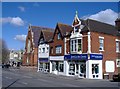
'Jewel in the Crown', Swindon
Swindon's largest Indian restaurant, on Victoria Road.
Image: © Roger Cornfoot
Taken: 13 Mar 2007
0.01 miles
2
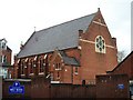
Trinity Hall
The building now houses a pre-school nursery.
Image: © Michael Dibb
Taken: 28 Mar 2017
0.02 miles

4
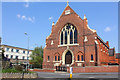
Former Church
Now a nursery, located on Clarence Street.
Image: © Wayland Smith
Taken: 10 Apr 2020
0.02 miles
5
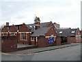
Holy Rood school
The primary school is adjacent to the church of the same name.
Image: © Michael Dibb
Taken: 28 Mar 2017
0.02 miles
6
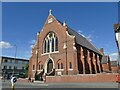
Former church, Clarence Street, Swindon
This was formerly a Presbyterian Church of England (i.e. a Protestant breakaway group). The denomination became part of the United Reformed Church in 1972. The church building closed in 1990 when the congregation moved into a new Pilgrim Centre nearby. It is now used by a nursery.
Image: © Stephen Craven
Taken: 14 Jul 2022
0.02 miles
7
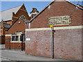
The school and hall
Holy Rood school and hall, from Durham Street. The inscription on the far wall is 'in hoc signo vinces' - by this sign you will conquer.
Image: © Neil Owen
Taken: 10 Jun 2014
0.03 miles
8
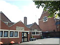
Church school and presbytery
The school and church buildings are part of the late 1800/early 1900s development of this part of Old Town. The old Holy Rood chapel was a short distance to the west before being redeveloped itself on the mid-1900s.
Image: © Neil Owen
Taken: 14 Jul 2022
0.03 miles
9
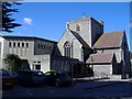
Holy Rood church, Swindon
A catholic church and primary school, viewed from Durham Street.
Image: © Roger Cornfoot
Taken: 13 Mar 2007
0.03 miles
10
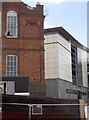
The rise of the new
The old technical college was founded in the late 1800s, but its role is about to change. Along with the new retail and leisure complex being built on the site of the old post-war block, the Victorian institution is to be converted into offices. See Image] for another view.
Image: © Neil Owen
Taken: 10 Jun 2014
0.03 miles