
IMAGES TAKEN NEAR TO
Drove Road, SWINDON, SN1 3AH
Introduction
This page details the photographs taken nearby to Drove Road, SN1 3AH by members of the Geograph project.
The Geograph project started in 2005 with the aim of publishing, organising and preserving representative images for every square kilometre of Great Britain, Ireland and the Isle of Man.

There are currently over 7.5m images from over14,400 individuals and you can help contribute to the project by visiting https://www.geograph.org.uk
Image Map
Images are licensed for reuse under creativecommons.org/licenses/by-sa/2.0
Notes
- Clicking on the map will re-center to the selected point.
- The higher the marker number, the further away the image location is from the centre of the postcode.
Image Listing (106 Images Found)
Images are licensed for reuse under creativecommons.org/licenses/by-sa/2.0
Image
Details
Distance
1
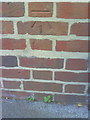
Benchmark on Drove School at dusk
Ordnance Survey cut mark benchmark described on the Bench Mark Database at http://www.bench-marks.org.uk/bm35752
Image: © Roger Templeman
Taken: 15 Oct 2010
0.00 miles
2
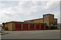
Swindon Fire Station
Swindon Fire Station, Drove Road, Swindon, Wiltshire
Image: © Kevin Hale
Taken: 8 May 2007
0.01 miles
3
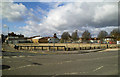
Site of Skurrays motor dealers, Drove Road, Swindon
Skurrays is a long-established motor dealership who hold franchises for Vauxhall and Chevrolet. The firm relocated a few years ago to a new site in west Swindon and the site in view became empty. Recently Aldi, the German-owned budget supermarket chain, obtained planning permission to build a new store here and the site has been cleared.
Image: © Brian Robert Marshall
Taken: 26 Feb 2010
0.02 miles
4
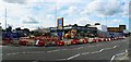
Site of Aldi supermarket, Drove Road, Swindon
Taken from almost the same spot as this one Image but nearly 18 months on and construction of a new supermarket is well underway. It is scheduled to open on 1st September 2011. This will be the second Aldi in Swindon.
Image: © Brian Robert Marshall
Taken: 24 Jul 2011
0.04 miles
5
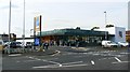
Aldi supermarket, Drove Road, Swindon
A few weeks on from this view http://www.geograph.org.uk/photo/2519361 and this branch of the German-owned supermarket chain has opened. This is the second outlet they have in Swindon.
Image: © Brian Robert Marshall
Taken: 15 Sep 2011
0.04 miles
6
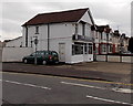
Chic Boutique, Swindon
Women's fashion clothes shop at 19 Drove Road, on the corner of Dudmore Road.
Image: © Jaggery
Taken: 14 Apr 2013
0.04 miles
7
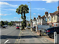
Drove Road
c.1930s housing in Drove Road, although the road itself is much older. the floodlights in the background are for Swindon Town FC's County Ground stadium.
Image: © Ian Capper
Taken: 14 Jul 2022
0.05 miles
8
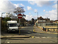
Plymouth Street at its junction with Drove Road, Swindon
Plymouth Street is part of what used to be known as the New Town part of Swindon. Although New Town still appears on some maps hardly anyone uses the name in contrast to the Old Town area, south of here and on a hill where, perhaps because it has some cachet, the term is commonly heard. Just visible to the right is the recently cleared site seen in this image Image For a view along Plymouth Street see this image Image At the left is a 2006-registered Ford Transit operated by BT. The Transit is perhaps the most ubiquitous 'white van' to be seen on Britain's road. It first appeared in the mid 1960s as a replacement for the Ford Thames. I haven't checked but I believe that the Transits are built in Slough or Southampton or perhaps both.
Image: © Brian Robert Marshall
Taken: 26 Feb 2010
0.05 miles
9
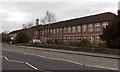
Drove Primary School, Swindon
The large school on the west side of Drove Road has about 550 pupils enrolled, ages 3-11.
Image: © Jaggery
Taken: 14 Apr 2013
0.06 miles
10
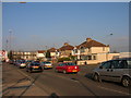
Swindon: Drove Road
Waiting to hit the Magic roundabout.
Image: © Alby
Taken: 29 Dec 2008
0.06 miles