
IMAGES TAKEN NEAR TO
The Close, CORSHAM, SN13 9PX
Introduction
This page details the photographs taken nearby to The Close, SN13 9PX by members of the Geograph project.
The Geograph project started in 2005 with the aim of publishing, organising and preserving representative images for every square kilometre of Great Britain, Ireland and the Isle of Man.

There are currently over 7.5m images from over14,400 individuals and you can help contribute to the project by visiting https://www.geograph.org.uk
Image Map
Images are licensed for reuse under creativecommons.org/licenses/by-sa/2.0
Notes
- Clicking on the map will re-center to the selected point.
- The higher the marker number, the further away the image location is from the centre of the postcode.
Image Listing (6 Images Found)
Images are licensed for reuse under creativecommons.org/licenses/by-sa/2.0
Image
Details
Distance
1
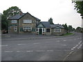
Harp and Crown, Gastard
A view looking to the west across the B3353, towards the Harp and Crown public house at Gastard. The signage on the building seems to have suffered somewhat.
Image: © Phil Williams
Taken: 30 Jun 2006
0.03 miles
2
Silver Street, Gastard
In 2009 the direction sign was on the other side of the road but looks like the same sign.
Image: © David Howard
Taken: 4 Jan 2020
0.05 miles
3
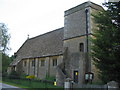
St. John the Baptist, Gastard
A view looking south to the church of St. John the Baptist at Gastard, with its unusual external steps to the tower.
Image: © Phil Williams
Taken: 30 Jun 2006
0.08 miles
4
2008 : Cottage on Lanes End, Gastard
The sign at the gate tells us eggs are available.
Image: © Maurice Pullin
Taken: 17 Feb 2008
0.19 miles
5
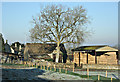
2008 : Lanes End Farm, Gastard
The last building on the north side of the lane when leaving Gastard.
Image: © Maurice Pullin
Taken: 17 Feb 2008
0.22 miles
6
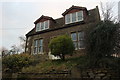
Cottage on Lanes End, Gastard
The dormer windows have been changed since 2009
Image: © David Howard
Taken: 4 Jan 2020
0.24 miles