
IMAGES TAKEN NEAR TO
High Street, CORSHAM, SN13 8NE
Introduction
This page details the photographs taken nearby to High Street, SN13 8NE by members of the Geograph project.
The Geograph project started in 2005 with the aim of publishing, organising and preserving representative images for every square kilometre of Great Britain, Ireland and the Isle of Man.

There are currently over 7.5m images from over14,400 individuals and you can help contribute to the project by visiting https://www.geograph.org.uk
Image Map
Images are licensed for reuse under creativecommons.org/licenses/by-sa/2.0
Notes
- Clicking on the map will re-center to the selected point.
- The higher the marker number, the further away the image location is from the centre of the postcode.
Image Listing (47 Images Found)
Images are licensed for reuse under creativecommons.org/licenses/by-sa/2.0
Image
Details
Distance
1
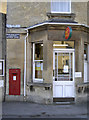
Box Post Office
Located on the A4 Bath Road, with some signs from a by-gone age adding to the character.
Image: © Neil Owen
Taken: 16 Jan 2012
0.02 miles
2
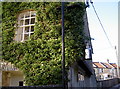
Unusual adornment
A shiny churn hanging outside a house in Market Place. Perhaps it was an old dairy?
Image: © Neil Owen
Taken: 16 Jan 2012
0.03 miles
3
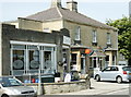
2008 : Post Office and stores, London Road, Box
The only Post Office I could find in Box.
Image: © Maurice Pullin
Taken: 13 May 2008
0.04 miles
4
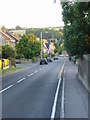
A4 London Road, Box
From the bridge crossing the railway line.
Image: © Nick Smith
Taken: 15 Sep 2007
0.04 miles
5
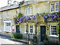
2008 : Wisteria on Frogmore House, Box
In Market Street.
See http://en.wikipedia.org/wiki/Wisteria for more about wisteria.
Image: © Maurice Pullin
Taken: 13 May 2008
0.07 miles
6
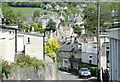
2008 : Market Place, Box
Seen from the southern end, Market Place runs alongside the A4 by a slightly more devious route.
Image: © Maurice Pullin
Taken: 13 May 2008
0.08 miles
7
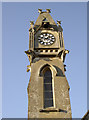
Anyone late will serve detention!
No chance of sneaking in after the bell with this clock dominating the school buildings. See Image] for a wider view.
Image: © Neil Owen
Taken: 16 Jan 2012
0.08 miles
8
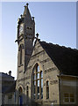
School on Box High Street
An ornate clock tower immediately draws the eye. See Image] for a closer view of it.
Image: © Neil Owen
Taken: 16 Jan 2012
0.08 miles
9
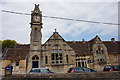
Church of England Primary School, High Street, Box
Image: © Ian S
Taken: 27 May 2016
0.09 miles
10
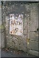
Old Milestone on London Road, Box
A metal plate attached to a stone wall on the east side of the A4 London Road, in the parish of BOX (NORTH WILTSHIRE District). Within the stone wall of the front garden, to the right of the gate of No. 1 Elmsleigh Villa, 20 metres south of the junction with Bargates and opposite Box Surgery. Bath incised iron plate Erected by the Bricker's Barn turnpike trust in the 19th century. Plate moved to Bradford-on-Avon museum before November 2023.
Inscription reads:- To / BATH / 6 / : : : . Listed.
Milestone Society National ID: WI_LB_BACN06.
Image: © A Rosevear
Taken: 5 Feb 2004
0.09 miles