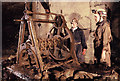
IMAGES TAKEN NEAR TO
Beech Road, CORSHAM, SN13 8HF
Introduction
This page details the photographs taken nearby to Beech Road, SN13 8HF by members of the Geograph project.
The Geograph project started in 2005 with the aim of publishing, organising and preserving representative images for every square kilometre of Great Britain, Ireland and the Isle of Man.

There are currently over 7.5m images from over14,400 individuals and you can help contribute to the project by visiting https://www.geograph.org.uk
Image Map
Images are licensed for reuse under creativecommons.org/licenses/by-sa/2.0
Notes
- Clicking on the map will re-center to the selected point.
- The higher the marker number, the further away the image location is from the centre of the postcode.
Image Listing (7 Images Found)
Images are licensed for reuse under creativecommons.org/licenses/by-sa/2.0
Image
Details
Distance
1
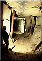
Box Mine, Clifftworks
Wood propping and stonewalling in main passage at Clifft works.
Image: © Nick Chipchase
Taken: 10 Mar 1999
0.01 miles
2
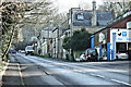
2008 : Garage and houses on the A4 at Box Hill
As it climbs the hill heading north east out of Box the A4 passes this interesting group of buildings. Probably missed by most passers by looking out for other things.
Image: © Maurice Pullin
Taken: 25 Feb 2008
0.03 miles
3
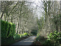
2008 : Beech Road, Box Hill
A well named lane. This would have been the original A4 - or its predecessor - before it was rebuilt at a lower level to make an easier gradient on the hill.
Image: © Maurice Pullin
Taken: 25 Feb 2008
0.05 miles
4
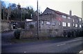
Clift entrance
This is the old workshops and offices of the Bath Stone Firms, now private residences. The doorway with the sign on is the entrance to Clift Quarry, part of the Box Quarry system that covers an area of nearly 600 acres.
Image: © Derek Hawkins
Taken: 1 Feb 2007
0.07 miles
5
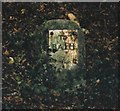
Old Milestone by the A4, London Road, Box Hill
Metal plate attached to stone post by the A4, in parish of Box (North Wiltshire District), London Road; 300m East of Box Hill Motors (Clift House) and Hedgesparrow Lane junction, in very steep bank under trees and ivy cover, on South side of road. Bath incised iron plate, erected by the Bricker's Barn turnpike trust in the 19th century.
Inscription reads:-
TO
BATH
7
Grade II listed.
List Entry Number: 1181579 https://historicengland.org.uk/listing/the-list/list-entry/1181579
Milestone Society National ID: WI_LB_BACN07
Image: © A Rosevear
Taken: 23 Sep 2003
0.07 miles
6
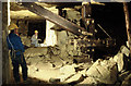
Box Stonemine
Old Crane used for hauling out stone blocks.
Image: © Nick Chipchase
Taken: 18 Mar 1998
0.22 miles