
IMAGES TAKEN NEAR TO
Henley Lane, CORSHAM, SN13 8EL
Introduction
This page details the photographs taken nearby to Henley Lane, SN13 8EL by members of the Geograph project.
The Geograph project started in 2005 with the aim of publishing, organising and preserving representative images for every square kilometre of Great Britain, Ireland and the Isle of Man.

There are currently over 7.5m images from over14,400 individuals and you can help contribute to the project by visiting https://www.geograph.org.uk
Image Map
Images are licensed for reuse under creativecommons.org/licenses/by-sa/2.0
Notes
- Clicking on the map will re-center to the selected point.
- The higher the marker number, the further away the image location is from the centre of the postcode.
Image Listing (12 Images Found)
Images are licensed for reuse under creativecommons.org/licenses/by-sa/2.0
Image
Details
Distance
1
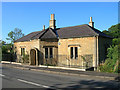
Old Toll House by Devizes Road, Box
Devizes Road Toll House by the A365, in parish of Box (North Wiltshire District), The Old Toll House, Devizes Road (Jockey Hill), SN13 8EJ.
Grade II listed.
List Entry Number: 1180913 https://historicengland.org.uk/listing/the-list/list-entry/1180913
Surveyed
Milestone Society National ID: WI.BOX01
Image: © Alan Rosevear
Taken: Unknown
0.09 miles
2
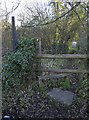
Back to the road
The footpath takes you across Box Bottom to the Devizes Road. Just mind yourself on the stile.
Image: © Neil Owen
Taken: 16 Jan 2012
0.13 miles
3
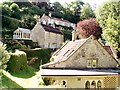
Washwell near Henley
The public footpath descends a steep hill and suddenly opens out into the hamlet of Washwell near the village of Henley.
Image: © Sharon Loxton
Taken: 30 Jul 2006
0.14 miles
4
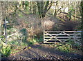
Bridle path through Thorn Wood
The gate is open, so bring your horse.
Image: © Neil Owen
Taken: 16 Jan 2012
0.17 miles
5
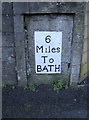
Milestone in Box
Located on the Devizes Road, opposite the Leys. Right beside it is a cut benchmark - see http://www.bench-marks.org.uk/bm41393 for the entry in the Benchmark Database.
Image: © Neil Owen
Taken: 16 Jan 2012
0.18 miles
6
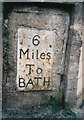
Old Milestone by the A365, Devizes Road, Box
Metal plate attached to stone post by the A365, in parish of Box (North Wiltshire District), Devizes Road; in garden wall of "Lyndale", opposite The Ley, set in stone retaining wall beside footpath and close to driveway, on South side of road. Erected by the Lacock, Blue Vein (Corsham) turnpike trust in the 19th century.
Inscription reads:-
6
Miles
To
BATH
Grade II listed.
List Entry Number: 1022767 https://historicengland.org.uk/listing/the-list/list-entry/1022767
Milestone Society National ID: WI_LB_BADZ06
Image: © A Rosevear
Taken: 2 Sep 2003
0.18 miles
7
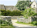
2008 : Henley Farm entrance
Henley consists mainly of Henley Farm and a few cottages.
Image: © Maurice Pullin
Taken: 13 May 2008
0.19 miles
8
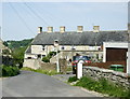
2008 : Henley near Washwell
If we could be rid of the overhead cables, the road signs are just about acceptable.
A pretty little hamlet, you have to look for it to find it.
Image: © Maurice Pullin
Taken: 13 May 2008
0.19 miles
9
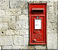
2008 : George VI postbox at Henley
At the top of the hill down to Box, about half a mile away.
Image: © Maurice Pullin
Taken: 13 May 2008
0.20 miles
10
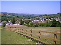
Box boxed
The features of most of the grid square containing Box can be seen here, looking north from a footpath that descends to the village. The A4 can be seen ascending Box Hill in the centre right of the photo. The railway line comes out of a small tunnel just behind the line of trees in the left middle distance (Middle Hill). It runs left to right on an embankment behind the village (above the white roofed building) then goes underneath the A4 and almost immediately enters Box tunnel. The valley in the centre background is that of the By Brook, having flowed towards us from Castle Combe. It flows under the railway, in front of Middle Hill and off to the west (left) towards Bath.
Image: © Graham Horn
Taken: 2 May 2007
0.20 miles