
IMAGES TAKEN NEAR TO
Bath Road, CORSHAM, SN13 8AG
Introduction
This page details the photographs taken nearby to Bath Road, SN13 8AG by members of the Geograph project.
The Geograph project started in 2005 with the aim of publishing, organising and preserving representative images for every square kilometre of Great Britain, Ireland and the Isle of Man.

There are currently over 7.5m images from over14,400 individuals and you can help contribute to the project by visiting https://www.geograph.org.uk
Image Map
Images are licensed for reuse under creativecommons.org/licenses/by-sa/2.0
Notes
- Clicking on the map will re-center to the selected point.
- The higher the marker number, the further away the image location is from the centre of the postcode.
Image Listing (13 Images Found)
Images are licensed for reuse under creativecommons.org/licenses/by-sa/2.0
Image
Details
Distance
1
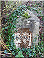
Milestone, A4, Ashley
Bath incised iron plate. In the SE verge. There is a Benchmark representing 37.1 m ASL.
To / Bath / 5
Milestone Society National ID: WI_LB_BACN05a
Image: © Abigail Newton
Taken: 4 Dec 2020
0.05 miles
2
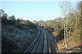
2008 : Paddington to Bristol main line
From a bridge on the A4 near Box, looking toward Bath.
Image: © Maurice Pullin
Taken: 12 Feb 2008
0.06 miles

4
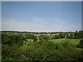
Rolling Somerset countryside #3, viewed from the A4 outside Box
Looking north-northwest from a Bath-bound National Express coach.
Image: © Robert Lamb
Taken: 31 Jul 2011
0.08 miles
5
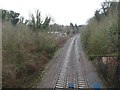
Box railway station (site), Wiltshire
Opened in 1841 by the Great Western Railway on its line from Swindon to Bristol Temple Meads, this station closed in 1965.
View east towards Box (Mill Lane) and Swindon. Image shows the station and was taken a few metres to the right, some 55 years earlier.
Image: © Nigel Thompson
Taken: 31 Mar 2018
0.13 miles
6
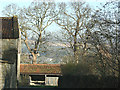
2008 : Ashley Farm, near Box
Looking between the buildings at the entrance to Ashley Farm. The hill beyond is on the other side of the valley.
Image: © Maurice Pullin
Taken: 12 Feb 2008
0.14 miles
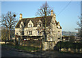
8

Box Station
View eastward, towards Swindon and London; ex-GWR Paddington - Bristol Main line. Station (classical Brunel) closed 4/1/65. A 'Warship' class Diesel-Hydraulic is passing on the 16.45 Paddington - Bristol - Taunton.
Image: © Ben Brooksbank
Taken: 12 Aug 1963
0.16 miles
9
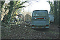
2008 : Abandonment near Ashley
Into every beauty spot a little grot must fall. Even here.
Image: © Maurice Pullin
Taken: 12 Feb 2008
0.17 miles
10
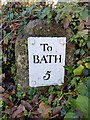
Milestone, Ashley
Not on the A4, this is an uncommitted road. Near Wormcliff Hill & Doctors Hill. The Benchmark at the base represents 123.3 m ASL.
To / Bath / 5
Milestone Society National ID: WI_LB_BACN05
Image: © Abigail Newton
Taken: 13 Nov 2020
0.17 miles