
IMAGES TAKEN NEAR TO
Hobbs Walk, CORSHAM, SN13 0EY
Introduction
This page details the photographs taken nearby to Hobbs Walk, SN13 0EY by members of the Geograph project.
The Geograph project started in 2005 with the aim of publishing, organising and preserving representative images for every square kilometre of Great Britain, Ireland and the Isle of Man.

There are currently over 7.5m images from over14,400 individuals and you can help contribute to the project by visiting https://www.geograph.org.uk
Image Map
Images are licensed for reuse under creativecommons.org/licenses/by-sa/2.0
Notes
- Clicking on the map will re-center to the selected point.
- The higher the marker number, the further away the image location is from the centre of the postcode.
Image Listing (144 Images Found)
Images are licensed for reuse under creativecommons.org/licenses/by-sa/2.0
Image
Details
Distance
1
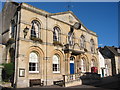
Corsham Town Hall
The New clock is waiting for hands!
Image: © Ben Croft
Taken: 1 Oct 2005
0.01 miles
2
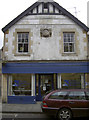
High Street vets
This shop is now a veterinary group's premises, but above the entrance is an interesting feature - perhaps not inappropriate for such occupants. See Image] for a closer look.
Image: © Neil Owen
Taken: 27 Mar 2014
0.01 miles
3
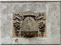
'Industry'
An interesting motif on the upper part of the wall of a shop in Corsham High Street. It appears to be a bee skep - a basket used as a hive for honey bees, a method dating back to pre-Christian times. See Image] for a look at the shop.
Image: © Neil Owen
Taken: 27 Mar 2014
0.01 miles
4
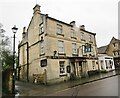
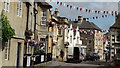
Corsham - The Royal Oak
Historic pub on Corsham's High Street, named the Royal Oak in 1899.
www.corshamroyaloak.co.uk
Image: © Colin Smith
Taken: 28 Feb 2020
0.01 miles
6
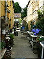
Hoofdstraat, Corsham
This narrow alley doubles as an outside display area for Theodora's, an emporium at the left selling flowers, plants and home decorations, and access to the dwelling at the end of the alley. The name of the alley doesn't appear on the maps but, no matter, I have a photo of the nameplate http://www.geograph.org.uk/photo/1944811
Image: © Brian Robert Marshall
Taken: 30 Jun 2010
0.03 miles
7
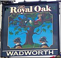
Sign for the Royal Oak, Corsham
Royal Oak is one of the most common pub names and is found throughout the country, and it primarily refers to an actual historical event. The celebrated historical event was the escape of Charles II after his army was defeated at Worcester in 1651, when he climbed into an oak tree at Boscobel to hide from the Parliamentary soldiers.
It also refers to one or other of the various Royal Naval warships that bear the name, and there is also a link to folklore too, since May 29th was celebrated as Royal Oak Day from 1661 until late into the 19th century.
Image: © Maigheach-gheal
Taken: 30 Jun 2010
0.03 miles
8
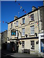
Royal Oak
The building at 72 Corsham High Street has been a public house since 1899.
Image: © Mark Percy
Taken: 22 Jul 2012
0.03 miles
9
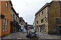
Corsham High Street
Looking south down the High Street.
Image: © Michael Garlick
Taken: 18 Sep 2014
0.03 miles
10
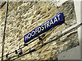
Hoofdstraat nameplate, Corsham
Corsham has Flemish connections - there is a row of cottages named Flemish Cottages nearby - and this nameplate on a wall near a narrow alley emphasises the link. The name means Main Street or High Street and is Dutch.
Image: © Brian Robert Marshall
Taken: 30 Jun 2010
0.03 miles