IMAGES TAKEN NEAR TO
York Close, CORSHAM, SN13 0EN
Introduction
This page details the photographs taken nearby to York Close, SN13 0EN by members of the Geograph project.
The Geograph project started in 2005 with the aim of publishing, organising and preserving representative images for every square kilometre of Great Britain, Ireland and the Isle of Man.

There are currently over 7.5m images from over14,400 individuals and you can help contribute to the project by visiting https://www.geograph.org.uk
Image Map
Images are licensed for reuse under creativecommons.org/licenses/by-sa/2.0
Notes
- Clicking on the map will re-center to the selected point.
- The higher the marker number, the further away the image location is from the centre of the postcode.
Image Listing (7 Images Found)
Images are licensed for reuse under creativecommons.org/licenses/by-sa/2.0
Image
Details
Distance
1
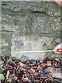
Milestone, A4, Corsham
Embedded in the wall.
To / Bath / 9
Milestone Society National ID: WI_LB_BACN09
Image: © Abigail Newton
Taken: Unknown
0.12 miles
2
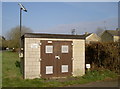
Gas station, Pickwick
Powered by electricity?
Image: © Neil Owen
Taken: 29 Feb 2012
0.13 miles
3
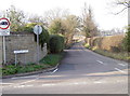
Hartham Lane
Heading northwest from the A4, Bath Road in Pickwick.
Image: © Neil Owen
Taken: 29 Feb 2012
0.14 miles
4
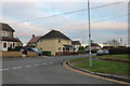
Dickens Avenue at the junction of Oliver Avenue
Image: © David Howard
Taken: 4 Jan 2020
0.17 miles
6
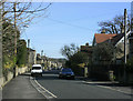
2010 : B3353 Pickwick Road, Corsham
Heading east through Corsham. The B3353 runs south from the A4 a few hundred yards behind the camera, if it ran north it would start with a 4.
Image: © Maurice Pullin
Taken: 2 Mar 2010
0.22 miles