
IMAGES TAKEN NEAR TO
Kings Avenue, CORSHAM, SN13 0EL
Introduction
This page details the photographs taken nearby to Kings Avenue, SN13 0EL by members of the Geograph project.
The Geograph project started in 2005 with the aim of publishing, organising and preserving representative images for every square kilometre of Great Britain, Ireland and the Isle of Man.

There are currently over 7.5m images from over14,400 individuals and you can help contribute to the project by visiting https://www.geograph.org.uk
Image Map
Images are licensed for reuse under creativecommons.org/licenses/by-sa/2.0
Notes
- Clicking on the map will re-center to the selected point.
- The higher the marker number, the further away the image location is from the centre of the postcode.
Image Listing (8 Images Found)
Images are licensed for reuse under creativecommons.org/licenses/by-sa/2.0
Image
Details
Distance
1
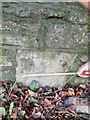
Milestone, A4, Corsham
Embedded in the wall.
To / Bath / 9
Milestone Society National ID: WI_LB_BACN09
Image: © Abigail Newton
Taken: Unknown
0.09 miles
2
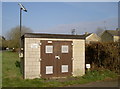
Gas station, Pickwick
Powered by electricity?
Image: © Neil Owen
Taken: 29 Feb 2012
0.09 miles
3
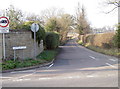
Hartham Lane
Heading northwest from the A4, Bath Road in Pickwick.
Image: © Neil Owen
Taken: 29 Feb 2012
0.10 miles
4
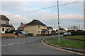
Dickens Avenue at the junction of Oliver Avenue
Image: © David Howard
Taken: 4 Jan 2020
0.21 miles
5
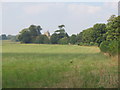
Hartham Park
Looking to the northwest across the parkland which forms the majority of this square. The tower of Hartham Chapel can be seen above the trees. The pheasant in the foreground was a bonus! Hartham Lane runs behind the hedge to the left.
Image: © Phil Williams
Taken: 22 Sep 2005
0.24 miles
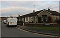
7
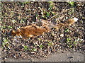
Alas, poor reynard!
A fox carcass, seeming to sink into the earth like a stricken ship. Not a fresh one, but probably not that old either.
Image: © Neil Owen
Taken: 29 Feb 2012
0.24 miles
8
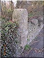
Old Milestone by the A4, west of Cross Keys, Corsham
Bath limestone with iron plate by the A4, in parish of Corsham (North Wiltshire District), about 150m West of Cross Keys crossroads and traffic lights, in dry stone wall, beside footpath, North side of road, now covered in ivy.
Surveyed
Milestone Society National ID: WI_lb_bacn09
Image: © Milestone Society
Taken: Unknown
0.25 miles