
IMAGES TAKEN NEAR TO
Church Street, CORSHAM, SN13 0BY
Introduction
This page details the photographs taken nearby to Church Street, SN13 0BY by members of the Geograph project.
The Geograph project started in 2005 with the aim of publishing, organising and preserving representative images for every square kilometre of Great Britain, Ireland and the Isle of Man.

There are currently over 7.5m images from over14,400 individuals and you can help contribute to the project by visiting https://www.geograph.org.uk
Image Map
Images are licensed for reuse under creativecommons.org/licenses/by-sa/2.0
Notes
- Clicking on the map will re-center to the selected point.
- The higher the marker number, the further away the image location is from the centre of the postcode.
Image Listing (141 Images Found)
Images are licensed for reuse under creativecommons.org/licenses/by-sa/2.0
Image
Details
Distance
1
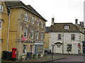
Corsham Post Office
On the corner of High Street and Church Street.
Image: © David M Clark
Taken: 22 Oct 2022
0.02 miles
2
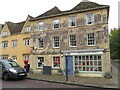
Corsham Post Office
In the centre of this attractive Cotswold village.
Image: © David M Clark
Taken: 22 Oct 2022
0.02 miles
3
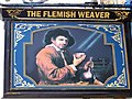
Sign for the Flemish Weaver
Edward III stopped wool exports from England in 1337. He then lured Flemish weavers to England, and many settled in the Cotswolds area where they had direct access to plentiful supplies of wool. They established a flourishing 'cottage' textile industry and were joined by more of their fellow countrymen in the 17th century when they were fleeing religious persecution.
Image: © Maigheach-gheal
Taken: 30 Jun 2010
0.02 miles
4
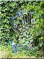
Decorative peacock, Corsham
In the small garden between the Flemish Weaver and the Town Hall is this decorative peacock.
Image: © Maigheach-gheal
Taken: 30 Jun 2010
0.02 miles
5
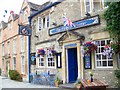
The Flemish Weaver, Corsham
The building dates from the late 17th century and is situated immediately next to the Town Hall. The inn was formerly known as the Packhorse Inn.
For a close-up of the sign http://www.geograph.org.uk/photo/2018541
Image: © Maigheach-gheal
Taken: 30 Jun 2010
0.02 miles
6
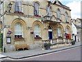
Town Hall, Corsham
The town hall was built in 1882 by W H Bromley of Corsham using parts of the old Market Hall that was built in 1784. It has a list K6 type telephone box immediately next to it.
In 1935, the Post Office commissioned a new kiosk from Sir Giles Gilbert Scott to celebrate the Jubilee of King George V. The K6 Jubilee Kiosk, as it is known, was similar to the K2 box, being made of cast iron and painted red but was 25% lighter in weight. By the end of the 1930s there were 20,000 K6 telephone boxes in use all over the UK.
There is also an Ordnance Survey bench mark on the south east angle.
Image: © Maigheach-gheal
Taken: 30 Jun 2010
0.03 miles
7
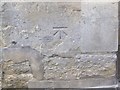
Bench Mark, Town Hall, Corsham
The bench mark is to be found on the south east angle of the building http://www.geograph.org.uk/photo/2018425 and for further information on the cut mark http://www.bench-marks.org.uk/bm25046
A bench mark is an Ordnance Survey arrowhead sign found on walls, bridges, churches and specially erected triangulation pillars where the altitude above sea-level has been accurately measured by surveyors. The arrowhead points to a horizontal line above it which marks the exact altitude.
With rivets and pivots there is no datum (horizontal line) cut, the pointed-to horizontal surface defining the datum height.
Image: © Maigheach-gheal
Taken: 30 Jun 2010
0.03 miles
8
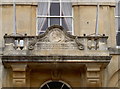
Victoria's sixtieth
Commemorating the Queen's lengthy reign, a clock was installed on the town hall.
Image: © Neil Owen
Taken: 27 Mar 2014
0.03 miles
9
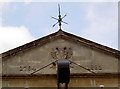
Top of the shop
The top of Corsham's town hall.
Image: © Neil Owen
Taken: 27 Mar 2014
0.03 miles
10
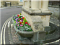
The Mayo Monument, Corsham (1)
The monument in the form of a drinking fountain was erected in 1898 by public subscription to commemorate Charles Mayo, a local man of independent means whose mission in life was the doing of good works for his adopted town of Corsham (his birthplace was Tunbridge Wells). He was a councillor and, as Chairman of the Corsham Water Company, was responsible for bringing piped water to the town. Charles died on holiday in Switzerland aged 61 in 1895. For a look at the whole monument see http://www.geograph.org.uk/photo/1944214
Image: © Brian Robert Marshall
Taken: 30 Jun 2010
0.03 miles