
IMAGES TAKEN NEAR TO
Wells Street, SWINDON, SN1 2JJ
Introduction
This page details the photographs taken nearby to Wells Street, SN1 2JJ by members of the Geograph project.
The Geograph project started in 2005 with the aim of publishing, organising and preserving representative images for every square kilometre of Great Britain, Ireland and the Isle of Man.

There are currently over 7.5m images from over14,400 individuals and you can help contribute to the project by visiting https://www.geograph.org.uk
Image Map
Images are licensed for reuse under creativecommons.org/licenses/by-sa/2.0
Notes
- Clicking on the map will re-center to the selected point.
- The higher the marker number, the further away the image location is from the centre of the postcode.
Image Listing (352 Images Found)
Images are licensed for reuse under creativecommons.org/licenses/by-sa/2.0
Image
Details
Distance
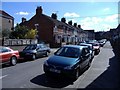
2
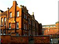
Former Clarence Street School, Swindon (1)
The school was built in 1897 and closed as a school about ninety years later. It is now used by the local authority social services department. The more modern building in the background is also used by the local council. Opened in 1990 it is called 'Wat Tyler House' after the poll tax rebel of 1381.
Image: © Brian Robert Marshall
Taken: 6 Feb 2007
0.03 miles
3
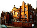
Former Clarence Street School, Swindon (2)
A wider view of the former junior school.
Image: © Brian Robert Marshall
Taken: 6 Feb 2007
0.03 miles
4
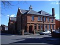
Studio apartments, Lincoln Street, Swindon
Recently converted from educational use.
Image: © Roger Cornfoot
Taken: 13 Mar 2007
0.03 miles
5
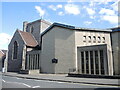
Holy Rood Catholic Church
A church of old and new parts.
Image: © Neil Owen
Taken: 14 Jul 2022
0.04 miles
6
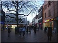
Regent Street, Swindon
Swindon's main shopping street, pedestrianised in the 1970's.
Image: © Roger Cornfoot
Taken: 2 Jan 2007
0.04 miles
7
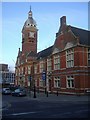
The old town hall, Swindon
Now the home to a national college of dance.
Image: © Roger Cornfoot
Taken: 2 Jan 2007
0.04 miles
8
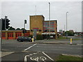
Fire station on the side of the Magic Roundabout
Image: © Rob Purvis
Taken: 10 Jul 2011
0.04 miles
9
![Parish church [1]](https://s0.geograph.org.uk/geophotos/05/33/67/5336748_41ddcf9a_120x120.jpg)
Parish church [1]
Holy Rood Catholic church was built in 1905, replacing an earlier building. A large hall adjoins which gives a concert space.
Image: © Michael Dibb
Taken: 28 Mar 2017
0.04 miles
10
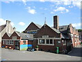
Holy Rood school and hall
The Roman Catholic school stands next to the church of the same order, and also close to the C of E Presbytery - parts of which are now lost under the newer parts of the school.
Image: © Neil Owen
Taken: 14 Jul 2022
0.05 miles