
IMAGES TAKEN NEAR TO
Ashley Close, MELKSHAM, SN12 8RH
Introduction
This page details the photographs taken nearby to Ashley Close, SN12 8RH by members of the Geograph project.
The Geograph project started in 2005 with the aim of publishing, organising and preserving representative images for every square kilometre of Great Britain, Ireland and the Isle of Man.

There are currently over 7.5m images from over14,400 individuals and you can help contribute to the project by visiting https://www.geograph.org.uk
Image Map
Images are licensed for reuse under creativecommons.org/licenses/by-sa/2.0
Notes
- Clicking on the map will re-center to the selected point.
- The higher the marker number, the further away the image location is from the centre of the postcode.
Image Listing (22 Images Found)
Images are licensed for reuse under creativecommons.org/licenses/by-sa/2.0
Image
Details
Distance
1
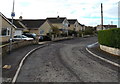
Kennedy Avenue, Whitley
Cul-de-sac on the west side of Middle Lane.
Image: © Jaggery
Taken: 3 Nov 2014
0.10 miles
2
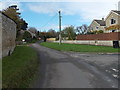
Middle Lane towards Top Lane, Whitley
Looking NW along Middle Lane past the right turn into Brookfield Rise.
Image: © Jaggery
Taken: 3 Nov 2014
0.11 miles
3
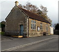
Whitley Reading Rooms and bench
Viewed across Middle Lane. The inscription above the door is READING ROOM ERECTED BY J.F.STANCOME 1904. The building is now (2014) a venue for many clubs and groups, such as
The Whitley Players who regularly stage drama productions here.
The bench was a fine location for this visitor's lunch break.
Image: © Jaggery
Taken: 3 Nov 2014
0.12 miles
4
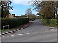
Middle Lane, Whitley
Looking NW across the B3353 Corsham Road. Middle Lane leads to Top Lane 450 metres ahead.
Image: © Jaggery
Taken: 3 Nov 2014
0.13 miles
5
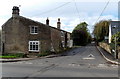
First Lane, Whitley
Looking west across the B3353 Corsham Road.
Image: © Jaggery
Taken: 3 Nov 2014
0.15 miles
6
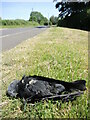
The end of the road on Top Lane
A sad victim lies at the roadside, resumably a vehicle strike.
Image: © Neil Owen
Taken: 15 Jun 2021
0.18 miles
7
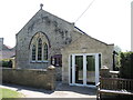
Whitley Methodist Church
The Wesleyan Methodist church stands near the north of the village, and sadly has a rather illegible datestone but is certainly a nineteenth century building. At the far end of the outer wall is a benchmark - see Image
Image: © Neil Owen
Taken: 15 Jun 2021
0.18 miles
8
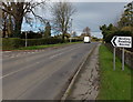
Corsham Road north of Middle Lane, Whitley
Turn left here into Middle Lane for the Reading Rooms. http://www.geograph.org.uk/photo/4240069
Image: © Jaggery
Taken: 3 Nov 2014
0.18 miles
9
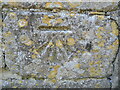
Benchmark on the Methodist church wall
Whitley Methodists congregate here; on the far end of the boundary wall is this benchmark dating from post-war times. See https://www.bench-marks.org.uk/bm152991 for the entry in the Benchmark Database and Image] for a location view.
Image: © Neil Owen
Taken: 15 Jun 2021
0.18 miles
10
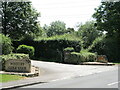
Two clubs for the enthusiast
The entrances to Whitley Golf and Cricket Clubs. The former is a 9-hole course that opened in 1993 on dairy land; the latter was previously known as the Golden Fleece C.C. until settling on the village name in 2019.
Image: © Neil Owen
Taken: 15 Jun 2021
0.20 miles