
IMAGES TAKEN NEAR TO
Top Lane, MELKSHAM, SN12 8RA
Introduction
This page details the photographs taken nearby to Top Lane, SN12 8RA by members of the Geograph project.
The Geograph project started in 2005 with the aim of publishing, organising and preserving representative images for every square kilometre of Great Britain, Ireland and the Isle of Man.

There are currently over 7.5m images from over14,400 individuals and you can help contribute to the project by visiting https://www.geograph.org.uk
Image Map
Images are licensed for reuse under creativecommons.org/licenses/by-sa/2.0
Notes
- Clicking on the map will re-center to the selected point.
- The higher the marker number, the further away the image location is from the centre of the postcode.
Image Listing (13 Images Found)
Images are licensed for reuse under creativecommons.org/licenses/by-sa/2.0
Image
Details
Distance
1
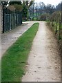
Driveway, Whitley
The drive serves as a footpath that takes walkers towards Lagard Farm and Folly Lane Farm.
Image: © Maigheach-gheal
Taken: 11 Apr 2010
0.05 miles
2
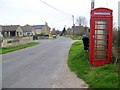
Telephone box, Purlpit
A K6 type telephone box in the Purlpit area of Whitley.
In 1935, the Post Office commissioned a new kiosk from Sir Giles Gilbert Scott to celebrate the Jubilee of King George V. The K6 Jubilee Kiosk, as it is known, was similar to the K2 box, being made of cast iron and painted red but was 25% lighter in weight. By the end of the 1930s there were 20,000 K6 telephone boxes in use all over the UK.
Image: © Maigheach-gheal
Taken: 11 Apr 2010
0.05 miles
3
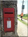
Getting and delivering the mail in Whitley
A George VI era letterbox, a W.T. Allen product set in the wall of a large house in Whitley, has been visited by postie.
Image: © Neil Owen
Taken: 15 Jun 2021
0.06 miles
4
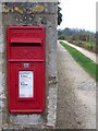
Postbox, Whitley
A George VI reign postbox set into a stone wall near the Pear Tree Inn.
Image: © Maigheach-gheal
Taken: 11 Apr 2010
0.06 miles
5
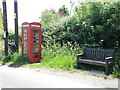
West Hill library
You can have a read in the fresh air if you like.
Image: © Neil Owen
Taken: 15 Jun 2021
0.07 miles
6
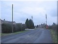
West Hill
A view looking east towards Whitley. The tall pole at left is a sewer ventilation pipe and appears to have lost the ornamented top that these things normally have.
Image: © Phil Williams
Taken: 27 Jan 2006
0.08 miles
7
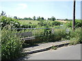
Bus stop and seat on West Hill
A new patch of pavement and railings are a courtesey for passengers, as is somewhere to rest. Hopefully the driver knows this as the request sign is being smothered by grass.
Image: © Neil Owen
Taken: 15 Jun 2021
0.11 miles
8
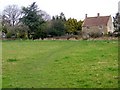
Footpath, Whitley
The footpath crosses the field towards another part of the village.
Image: © Maigheach-gheal
Taken: 11 Apr 2010
0.16 miles
9
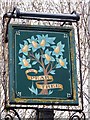
Sign for the Pear Tree
The name suggests the presence of such a tree, or an indication that perry, a drink like cider, only made from pears instead of apples, was for sale.
Image: © Maigheach-gheal
Taken: 11 Apr 2010
0.16 miles
10
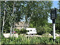
The Pear Tree Inn
The pub is actually set a fair distance from the main road, with a car park nearer. The pub is a fairly recent development of a seventeenth century farmhouse.
Image: © Neil Owen
Taken: 15 Jun 2021
0.16 miles