
IMAGES TAKEN NEAR TO
Pembroke Road, MELKSHAM, SN12 7NB
Introduction
This page details the photographs taken nearby to Pembroke Road, SN12 7NB by members of the Geograph project.
The Geograph project started in 2005 with the aim of publishing, organising and preserving representative images for every square kilometre of Great Britain, Ireland and the Isle of Man.

There are currently over 7.5m images from over14,400 individuals and you can help contribute to the project by visiting https://www.geograph.org.uk
Image Map
Images are licensed for reuse under creativecommons.org/licenses/by-sa/2.0
Notes
- Clicking on the map will re-center to the selected point.
- The higher the marker number, the further away the image location is from the centre of the postcode.
Image Listing (74 Images Found)
Images are licensed for reuse under creativecommons.org/licenses/by-sa/2.0
Image
Details
Distance
1
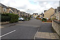
New Lawns, Melksham
Cul-de-sac on the north side of Spa Road.
Image: © Jaggery
Taken: 5 Nov 2014
0.13 miles
2
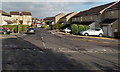
Rope Walk, Melksham
Cul-de-sac on the NE side of Spa Road.
Image: © Jaggery
Taken: 5 Nov 2014
0.15 miles
3
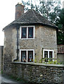
Former drying stove, Melksham
Associated with a related weaving workshop called Lowbourne Factory. This is an octagonal stove built in the mid-eighteenth century and now converted to accommodation. It is listed Grade II.
Image: © Chris Allen
Taken: 8 Jan 2012
0.15 miles
4
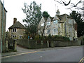
Melksham - small textile factory and drying stove
Mid-eighteenth century weaving workshop known as Lowbourne Factory with an associated octagonal drying stove that is now accommodation. Listed Grade II
Image: © Chris Allen
Taken: 8 Jan 2012
0.15 miles
5
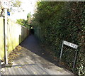
Hardie Walk, Melksham
Viewed from Spa Road. Below the No Cycling sign, a blue sign pointing along Hardie Walk shows
Lost Waterway of Melksham
Town Walk.
Image: © Jaggery
Taken: 5 Nov 2014
0.17 miles
6
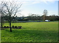
2009 : Public open space, Melksham
One of the few bright spots in a rather dull new housing development east of Melksham.
Image: © Maurice Pullin
Taken: 20 Jan 2009
0.17 miles
7
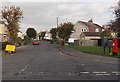
Coronation Road, Melksham
Viewed across Spa Road. The yellow temporary sign on the left gives details of road closures
later in the month. The red postbox is from the reign of King George VI. http://www.geograph.org.uk/photo/4237771
Image: © Jaggery
Taken: 5 Nov 2014
0.17 miles
8
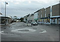
2009 : A3102 Lowbourne, Melksham
Heading east to Calne.
The mini roundabout is at the junction of Bank Street to the left and High Street to the right.
Image: © Maurice Pullin
Taken: 6 Dec 2009
0.18 miles
9
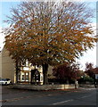
Dominant tree in Spa Road, Melksham
In front of Wansbroughs solicitors office at 7 Spa Road.
Image: © Jaggery
Taken: 5 Nov 2014
0.19 miles
10
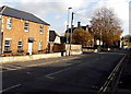
Spa Road, Melksham
Spa Road heads ESE away from Market Place in the town centre.
Image: © Jaggery
Taken: 5 Nov 2014
0.19 miles