
IMAGES TAKEN NEAR TO
Willow Close, MELKSHAM, SN12 6UT
Introduction
This page details the photographs taken nearby to Willow Close, SN12 6UT by members of the Geograph project.
The Geograph project started in 2005 with the aim of publishing, organising and preserving representative images for every square kilometre of Great Britain, Ireland and the Isle of Man.

There are currently over 7.5m images from over14,400 individuals and you can help contribute to the project by visiting https://www.geograph.org.uk
Image Map
Images are licensed for reuse under creativecommons.org/licenses/by-sa/2.0
Notes
- Clicking on the map will re-center to the selected point.
- The higher the marker number, the further away the image location is from the centre of the postcode.
Image Listing (58 Images Found)
Images are licensed for reuse under creativecommons.org/licenses/by-sa/2.0
Image
Details
Distance
1
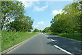
A350 Western Way, Melksham
A bypass to the west of the town.
Image: © Robin Webster
Taken: 30 May 2021
0.13 miles
2
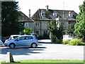
Melksham House, Melksham
Melksham House, west of the Market Place
This 18th century house, used as a social club by the Avon Rubber Company between 1920 and 2011, is now in Wiltshire Council ownership. On the left is part of a public car park.
Grade II listed - https://www.historicengland.org.uk/listing/the-list/list-entry/1285783
Image: © Steve Roberts
Taken: 26 Aug 2016
0.16 miles
3
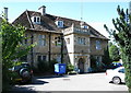
Facade of Melksham House, Melksham
This 18th century house, used as a social club by the Avon Rubber Company between 1920 and 2011, is now in Wiltshire Council ownership. The porch is a 19th century addition.
Grade II listed - https://www.historicengland.org.uk/listing/the-list/list-entry/1285783
Image: © Steve Roberts
Taken: 26 Aug 2016
0.16 miles
4
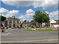
Melksham Town Hall
The junction of King Street, Spa Road and the High Street meets here with the Town Hall, Assembly Hall and, behind the Assembly Hall, the sports centre.
Image: © Doug Lee
Taken: 28 Aug 2005
0.19 miles
5
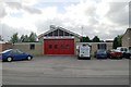
Melksham fire station
Melksham fire station, Semington Road, Melksham, Wiltshire
Image: © Kevin Hale
Taken: 18 Jun 2007
0.20 miles
6
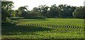
Maize, Melksham
Curving lines of young maize growing between the Western Way bypass and the River Avon, which turns a meander past the trees on the far side.
Image: © Derek Harper
Taken: 30 May 2009
0.20 miles
7
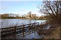
Flooded fields beside the River Avon
After a night of heavy rain, and on top of very heavy rain four days ago the Avon has burst its banks. Flooding to the south of the river in this location is reasonably frequent, but this level is somewhat higher than normal.
The normal location of the river is marked by the line trees in the mid-distance.
Image: © Doug Lee
Taken: 15 Jan 2008
0.20 miles
8
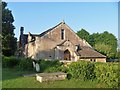
Now dwellings
This interesting former school has been converted into dwellings.
Image: © Michael Dibb
Taken: 20 May 2018
0.20 miles
9
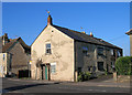
Old Toll House by King Street, Melksham
Semington Lane (King Street) by the B3104, in parish of Melksham (West Wiltshire District), No. 75, King Street, SN12.
Surveyed
Milestone Society National ID: WI.MEL01
Image: © Alan Rosevear
Taken: Unknown
0.21 miles
10
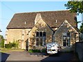
Once a tithe barn
This circa 15th century tithe barn was converted into a school in 1878 and is now dwellings. Listed, grade II, with details at: https://www.historicengland.org.uk/listing/the-list/list-entry/1364169
Image: © Michael Dibb
Taken: 20 May 2018
0.21 miles