
IMAGES TAKEN NEAR TO
Berhills Lane, MELKSHAM, SN12 6RR
Introduction
This page details the photographs taken nearby to Berhills Lane, SN12 6RR by members of the Geograph project.
The Geograph project started in 2005 with the aim of publishing, organising and preserving representative images for every square kilometre of Great Britain, Ireland and the Isle of Man.

There are currently over 7.5m images from over14,400 individuals and you can help contribute to the project by visiting https://www.geograph.org.uk
Image Map
Images are licensed for reuse under creativecommons.org/licenses/by-sa/2.0
Notes
- Clicking on the map will re-center to the selected point.
- The higher the marker number, the further away the image location is from the centre of the postcode.
Image Listing (28 Images Found)
Images are licensed for reuse under creativecommons.org/licenses/by-sa/2.0
Image
Details
Distance
1
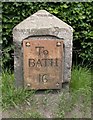
Old Milestone by the A365, Bath Road, Sells Green, Seend parish
Metal plate attached to stone post by the A365, in parish of SEEND (KENNET District), Bath Road; Sells Green by Cheyne Cottage, on narrow cut on grass verge between road and beech hedge around garden, on North side of road. Bath incised iron plate, erected by the Melksham turnpike trust in the 19th century.
Inscription reads:-
To
BATH
16
Grade II listed.
List Entry Number: 1272631 https://historicengland.org.uk/listing/the-list/list-entry/1272631
Milestone Society National ID: WI_LB_BADZ16.
Image: © M Faherty
Taken: 8 Jun 2007
0.10 miles
2
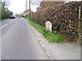
A365, Sells Green
Milestone beside the A365.
Milestones are the original roadside heritage features with many dating back hundreds of years and these historic items are under threat from highway developments.
Image: © Maigheach-gheal
Taken: 11 Apr 2010
0.10 miles
3
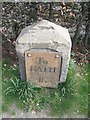
Milestone, Sells Green
Milestone beside the A365. For a wider view Image
Milestones did not come into general use until the Turnpike Act of 1766 made them compulsory on turnpike roads, these roads were built by private enterprise under licence from the Government and maintained by tolls on those who used them. Before this Act milestones were put up occasionally, often as charitable acts and commemorations. Many Turnpike Act stones still exist. They are usually 2-3 ft high, with the initial letter or abbreviation of the nearest market town show on two faces, and the distance from it.
Image: © Maigheach-gheal
Taken: 11 Apr 2010
0.10 miles
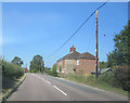
5
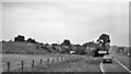
Site of Bromham & Rode Halt
View eastward, towards Devizes and Patney & Chirton; ex-Great Western, Patney & Chirton - Devizes - Holt Junction line, closed completely 18/4/66; no trace of Halt on remaining embankment. (My Morris 1800 parked in lay-by).
Image: © Ben Brooksbank
Taken: 10 Sep 1973
0.13 miles
7
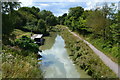
Kennet and Avon Canal, west of the A365 Bath Road bridge
Image: © David Martin
Taken: 31 Jul 2018
0.17 miles
8
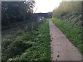
Kennet & Avon Canal Walk
Kennet & Avon Canal Walk at Martinslade Bridge No 148
Image: © Shaun Ferguson
Taken: 3 Nov 2017
0.17 miles
10
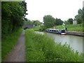
Near Martinslade Bridge
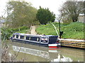
The wonderfully named narrowboat Puddleduck is moored near Martinslade Bridge which carries Bath Road (A365) over the Kennet & Avon canal. Seen from the towpath, a public footpath.
Image: © Michael Dibb
Taken: 26 Oct 2014
0.17 miles