
IMAGES TAKEN NEAR TO
Spout Lane, MELKSHAM, SN12 6PE
Introduction
This page details the photographs taken nearby to Spout Lane, SN12 6PE by members of the Geograph project.
The Geograph project started in 2005 with the aim of publishing, organising and preserving representative images for every square kilometre of Great Britain, Ireland and the Isle of Man.

There are currently over 7.5m images from over14,400 individuals and you can help contribute to the project by visiting https://www.geograph.org.uk
Image Map
Images are licensed for reuse under creativecommons.org/licenses/by-sa/2.0
Notes
- Clicking on the map will re-center to the selected point.
- The higher the marker number, the further away the image location is from the centre of the postcode.
Image Listing (56 Images Found)
Images are licensed for reuse under creativecommons.org/licenses/by-sa/2.0
Image
Details
Distance
1
![Seend houses [8]](https://s1.geograph.org.uk/geophotos/07/38/47/7384733_bb18e3d7_120x120.jpg)
Seend houses [8]
Rowcroft Cottage, Spout Lane, was originally two cottages, now one. Built in the 18th century, incorporating an earlier 17th century building and extended in the 19th century. Constructed of red brick and chequer brick under a Bridgwater tile roof, with a slate roof to the 19th century addition. The main range has a rubble stone west end wall, showing the line of the earlier house. Some original internal features remain. Listed, grade II, with details at: https://historicengland.org.uk/listing/the-list/list-entry/1243960
Seend is a hilltop village about 3¾ miles west of Devizes and some 5¾ miles northeast of Trowbridge. The name is from the Old English word ‘sende’ meaning a sandy place. It lies astride the A361 road from Devizes to Trowbridge, which was once the main road from London to Bath. The village has medieval origins, but there is evidence of occupation in Neolithic times. Farming, especially of wool, and later iron ore brought prosperity to Seend, which today is essentially a commuter village.
Image: © Michael Dibb
Taken: 13 Jan 2023
0.00 miles
2
![Seend ways [2]](https://s0.geograph.org.uk/geophotos/07/38/47/7384720_740fca39_120x120.jpg)
Seend ways [2]
From Spout Lane, this path runs across fields to where the A365 road crosses the Kennet and Avon Canal at Martinslade.
Seend is a hilltop village about 3¾ miles west of Devizes and some 5¾ miles northeast of Trowbridge. The name is from the Old English word ‘sende’ meaning a sandy place. It lies astride the A361 road from Devizes to Trowbridge, which was once the main road from London to Bath. The village has medieval origins, but there is evidence of occupation in Neolithic times. Farming, especially of wool, and later iron ore brought prosperity to Seend, which today is essentially a commuter village.
Image: © Michael Dibb
Taken: 13 Jan 2023
0.07 miles
3
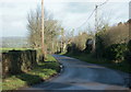
2009 : Looking north on Spout Lane
Linking Seend and Sells Green.
Image: © Maurice Pullin
Taken: 6 Dec 2009
0.07 miles
4
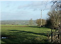
2009 : North from Spout Lane
Looking over fields near Egypt Farm toward Sandridge Park in the distance.
Image: © Maurice Pullin
Taken: 6 Dec 2009
0.08 miles
5
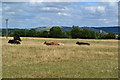
Cows in dry field at Seend
Roundway Hill in the distance.
Image: © David Martin
Taken: 31 Jul 2018
0.12 miles
6
![Seend houses [7]](https://s0.geograph.org.uk/geophotos/07/38/47/7384700_6d5a0038_120x120.jpg)
Seend houses [7]
Egypt Farmhouse was built in the mid to late 18th century. Constructed of brick with ashlar dressings under a stone slate roof. This view in January 2023 shows more of the building than the earlier image in October 2014 Image Listed, grade II, with details at: https://historicengland.org.uk/listing/the-list/list-entry/1272632
Seend is a hilltop village about 3¾ miles west of Devizes and some 5¾ miles northeast of Trowbridge. The name is from the Old English word ‘sende’ meaning a sandy place. It lies astride the A361 road from Devizes to Trowbridge, which was once the main road from London to Bath. The village has medieval origins, but there is evidence of occupation in Neolithic times. Farming, especially of wool, and later iron ore brought prosperity to Seend, which today is essentially a commuter village.
Image: © Michael Dibb
Taken: 17 Jan 2023
0.13 miles
7
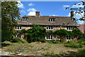
Egypt Farm
Farmhouse garden looking rather overgrown.
Image: © David Martin
Taken: 31 Jul 2018
0.13 miles
8
![Seend houses [6]](https://s1.geograph.org.uk/geophotos/04/22/58/4225861_185f720c_120x120.jpg)
Seend houses [6]
Egypt Farmhouse was built in the mid to late 18th century. Constructed of brick with ashlar dressings under a stone slate roof. There is another image of the building at Image Listed, grade II, with details at: https://historicengland.org.uk/listing/the-list/list-entry/1272632
Seend is a hilltop village about 3¾ miles west of Devizes and some 5¾ miles northeast of Trowbridge. The name is from the Old English word ‘sende’ meaning a sandy place. It lies astride the A361 road from Devizes to Trowbridge, which was once the main road from London to Bath. The village has medieval origins, but there is evidence of occupation in Neolithic times. Farming, especially of wool, and later iron ore brought prosperity to Seend, which today is essentially a commuter village.
Image: © Michael Dibb
Taken: 26 Oct 2014
0.13 miles
9
![Seend features [8]](https://s1.geograph.org.uk/geophotos/07/38/40/7384001_84299ec0_120x120.jpg)
Seend features [8]
In the same part of the very muddy field as the image from 2014 Image, some cattle are enjoying a late breakfast or perhaps an early lunch.
Seend is a hilltop village about 3¾ miles west of Devizes and some 5¾ miles northeast of Trowbridge. The name is from the Old English word ‘sende’ meaning a sandy place. It lies astride the A361 road from Devizes to Trowbridge, which was once the main road from London to Bath. The village has medieval origins, but there is evidence of occupation in Neolithic times. Farming, especially of wool, and later iron ore brought prosperity to Seend, which today is essentially a commuter village.
Image: © Michael Dibb
Taken: 13 Jan 2023
0.13 miles
10
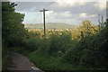
Spout Lane, Seend
This narrow lane leads down from Seend to the Kennet and Avon Canal and Sells Green.
Image: © Stephen McKay
Taken: 13 Sep 2011
0.14 miles