
IMAGES TAKEN NEAR TO
Dial Close, MELKSHAM, SN12 6NP
Introduction
This page details the photographs taken nearby to Dial Close, SN12 6NP by members of the Geograph project.
The Geograph project started in 2005 with the aim of publishing, organising and preserving representative images for every square kilometre of Great Britain, Ireland and the Isle of Man.

There are currently over 7.5m images from over14,400 individuals and you can help contribute to the project by visiting https://www.geograph.org.uk
Image Map
Images are licensed for reuse under creativecommons.org/licenses/by-sa/2.0
Notes
- Clicking on the map will re-center to the selected point.
- The higher the marker number, the further away the image location is from the centre of the postcode.
Image Listing (142 Images Found)
Images are licensed for reuse under creativecommons.org/licenses/by-sa/2.0
Image
Details
Distance
1
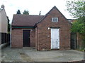
Seend Telephone Exchange, Wilts
Situated on the A361 High Street, this TE provides telephone and broadband services to Seend, plus Bulkington, Poulshot, Seend Cleeve and Sells Green nearby. Two BT warning notices are fixed to the white door whilst a louvre has been fitted above it. The extension on the left would have been added somewhile after the original TE on the right was built in the GPO era, ie before 1969. This TE has (01380) 828xxx numbers and its postcode is SN12 6NW.
Image: © David Hillas
Taken: 11 Apr 2011
0.04 miles
2
![Seend houses [33]](https://s2.geograph.org.uk/geophotos/07/38/63/7386302_4127574a_120x120.jpg)
Seend houses [33]
Numbers 1 to 4 High Street are a row of 4 houses built in the 18th century. Numbers 1 and 2 are a 17th century timber framed range, refronted in red brick. Numbers 3 and 4 are of painted red brick, with ashlar dressings. The roofs are of Bridgwater tile to numbers 1 and 2, and of slate to numbers 3 and 4. Listed, grade II, with details at: https://historicengland.org.uk/listing/the-list/list-entry/1272703
Seend is a hilltop village about 3¾ miles west of Devizes and some 5¾ miles northeast of Trowbridge. The name is from the Old English word ‘sende’ meaning a sandy place. It lies astride the A361 road from Devizes to Trowbridge, which was once the main road from London to Bath. The village has medieval origins, but there is evidence of occupation in Neolithic times. Farming, especially of wool, and later iron ore brought prosperity to Seend, which today is essentially a commuter village.
Image: © Michael Dibb
Taken: 13 Jan 2023
0.05 miles
3
![Seend houses [34]](https://s0.geograph.org.uk/geophotos/07/38/63/7386304_ea2fdbbb_120x120.jpg)
Seend houses [34]
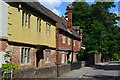
Dial House, High Street, was originally built in the 15th century and was encased in red brick with ashlar dressings in the 18th century, under a stone slate roof. The front to High Street has a massive projecting 15th century ashlar chimney with a sundial. Some early interior features remain. Listed, grade II, with details at: https://historicengland.org.uk/listing/the-list/list-entry/1243834
Seend is a hilltop village about 3¾ miles west of Devizes and some 5¾ miles northeast of Trowbridge. The name is from the Old English word ‘sende’ meaning a sandy place. It lies astride the A361 road from Devizes to Trowbridge, which was once the main road from London to Bath. The village has medieval origins, but there is evidence of occupation in Neolithic times. Farming, especially of wool, and later iron ore brought prosperity to Seend, which today is essentially a commuter village.
Image: © Michael Dibb
Taken: 13 Jan 2023
0.05 miles
5
![Seend houses [32]](https://s3.geograph.org.uk/geophotos/07/38/62/7386299_27ff1694_120x120.jpg)
Seend houses [32]
Church Corner Lodge, High Street, was originally the gate lodge to Seend House. Built in the early 19th century, of ashlar under a slate roof. There is a Roman Doric portico. There are 19th and 20th century extensions in red brick to the rear. Attached to the lodge are two ashlar gate piers with short lengths of curved wall on each side out to the road. Listed, grade II, with details at: https://historicengland.org.uk/listing/the-list/list-entry/1243878
Seend is a hilltop village about 3¾ miles west of Devizes and some 5¾ miles northeast of Trowbridge. The name is from the Old English word ‘sende’ meaning a sandy place. It lies astride the A361 road from Devizes to Trowbridge, which was once the main road from London to Bath. The village has medieval origins, but there is evidence of occupation in Neolithic times. Farming, especially of wool, and later iron ore brought prosperity to Seend, which today is essentially a commuter village.
Image: © Michael Dibb
Taken: 13 Jan 2023
0.07 miles
6
![Seend buildings [4]](https://s1.geograph.org.uk/geophotos/04/22/63/4226397_db9eb900_120x120.jpg)
Seend buildings [4]
In Rusty lane, this recent building serves as a community centre, village hall and as a pavilion for the adjacent recreation ground.
Seend is a hilltop village about 3¾ miles west of Devizes and some 5¾ miles northeast of Trowbridge. The name is from the Old English word ‘sende’ meaning a sandy place. It lies astride the A361 road from Devizes to Trowbridge, which was once the main road from London to Bath. The village has medieval origins, but there is evidence of occupation in Neolithic times. Farming, especially of wool, and later iron ore brought prosperity to Seend, which today is essentially a commuter village.
Image: © Michael Dibb
Taken: 26 Oct 2014
0.07 miles
7
![Seend features [10]](https://s2.geograph.org.uk/geophotos/07/38/55/7385522_1643ea05_120x120.jpg)
Seend features [10]
The garden wall to the former vicarage in High Street runs for some 40 yards and returns along Rusty Lane for some 27 yards. Probably erected in the late 18th century, the High Street length is in red brick, the Rusty Lane length is in rubble stone. The gate, near the corner of Rusty Lane is seen at Image Listed, grade II, with details at: https://historicengland.org.uk/listing/the-list/list-entry/1243833
Seend is a hilltop village about 3¾ miles west of Devizes and some 5¾ miles northeast of Trowbridge. The name is from the Old English word ‘sende’ meaning a sandy place. It lies astride the A361 road from Devizes to Trowbridge, which was once the main road from London to Bath. The village has medieval origins, but there is evidence of occupation in Neolithic times. Farming, especially of wool, and later iron ore brought prosperity to Seend, which today is essentially a commuter village.
Image: © Michael Dibb
Taken: 13 Jan 2023
0.07 miles
8
![Seend ways [5]](https://s1.geograph.org.uk/geophotos/04/22/63/4226385_0752ef15_120x120.jpg)
Seend ways [5]
From the High Street, Rusty Lane leads to the community centre and, beyond, a number of footpath and bridleways.
Seend is a hilltop village about 3¾ miles west of Devizes and some 5¾ miles northeast of Trowbridge. The name is from the Old English word ‘sende’ meaning a sandy place. It lies astride the A361 road from Devizes to Trowbridge, which was once the main road from London to Bath. The village has medieval origins, but there is evidence of occupation in Neolithic times. Farming, especially of wool, and later iron ore brought prosperity to Seend, which today is essentially a commuter village.
Image: © Michael Dibb
Taken: 26 Oct 2014
0.07 miles
9
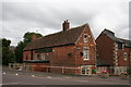
Seend: The 'Bell' Inn
The building behind is the former brewhouse.
Image: © Dr Neil Clifton
Taken: 21 Aug 2014
0.07 miles
10
![Seend features [11]](https://s2.geograph.org.uk/geophotos/04/22/63/4226374_abc04d5c_120x120.jpg)
Seend features [11]
This gate is in the garden wall of the former vicarage along High Street, near the junction with Rusty Lane. Erected, probably, in the late 18th century. The wall is seen at Image Listed grade II with details at https://historicengland.org.uk/listing/the-list/list-entry/1243833
Seend is a hilltop village about 3¾ miles west of Devizes and some 5¾ miles northeast of Trowbridge. The name is from the Old English word ‘sende’ meaning a sandy place. It lies astride the A361 road from Devizes to Trowbridge, which was once the main road from London to Bath. The village has medieval origins, but there is evidence of occupation in Neolithic times. Farming, especially of wool, and later iron ore brought prosperity to Seend, which today is essentially a commuter village.
Image: © Michael Dibb
Taken: 26 Oct 2014
0.08 miles