
IMAGES TAKEN NEAR TO
Portal Road, MELKSHAM, SN12 6GN
Introduction
This page details the photographs taken nearby to Portal Road, SN12 6GN by members of the Geograph project.
The Geograph project started in 2005 with the aim of publishing, organising and preserving representative images for every square kilometre of Great Britain, Ireland and the Isle of Man.

There are currently over 7.5m images from over14,400 individuals and you can help contribute to the project by visiting https://www.geograph.org.uk
Image Map
Images are licensed for reuse under creativecommons.org/licenses/by-sa/2.0
Notes
- Clicking on the map will re-center to the selected point.
- The higher the marker number, the further away the image location is from the centre of the postcode.
Image Listing (10 Images Found)
Images are licensed for reuse under creativecommons.org/licenses/by-sa/2.0
Image
Details
Distance
1
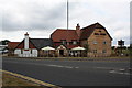
Bucking the trend - The Milk Churn - a new pub!!!
This amazing sight now adorns the A350 Semington bypass. Whilst pubs are said to be closing by the twenties each week, Hall and Woodhouse have built a new pub out of their normal catchment area. The sign has the Badger motif on it as well. It has only opened in the last few weeks.
Image: © John Stephen
Taken: 16 Jul 2014
0.05 miles
2
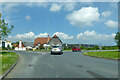
The Milk Churn
'Country pub and dining', but it is really in a business park - Hampton Park West.
Image: © Robin Webster
Taken: 30 May 2021
0.07 miles
3
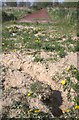
A long jump for a rabbit
The sand pits at either end of the unused long jump and triple jump track provide easy digging for the rabbits that have constructed rather extensive warrens here.
Image: © Doug Lee
Taken: 19 Apr 2009
0.16 miles
4
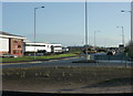
2009 : New trading estate near Outmarsh, Melksham
A flat, uninteresting area between Melksham and the K & A Canal at Semington. The ideal place to put a trading estate.
The roundabout is on Semington Road.
Image: © Maurice Pullin
Taken: 6 Dec 2009
0.16 miles
5
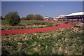
Unused running track
The running track here was laid in 1983 by Avon Rubber apparently as an investigation into the practicalities of all-weather tracks. Although on land managed by Christie Miller Sports Centre, the track is not maintained as there have not been the funds to do so.
Image: © Doug Lee
Taken: 19 Apr 2009
0.19 miles
6
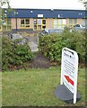
Maps Worldwide
Maybe not quite the cachet of Stanfords, but a map shop is quite a rarity, even though this organisation trades mostly on the internet. I was tempted to call in, and the sign makes clear that personal customers are welcome, but I didn't really need any maps. This is the Evans Business Centre, a fairly recent addition to the landscape.
Image: © Derek Harper
Taken: 20 Jul 2011
0.21 miles
7
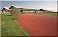
Unused running track
The running track here was laid in 1983 by Avon Rubber apparently as an investigation into the practicalities of all-weather tracks. Although on land managed by Christie Miller Sports Centre, the track is not maintained as there have not been the funds to do so.
Image: © Doug Lee
Taken: 19 Apr 2009
0.21 miles
8
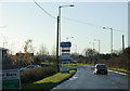
2009 : A gallimaufry of signs on Semington Road
Mostly advertising premises to let on a new industrial estate.
Image: © Maurice Pullin
Taken: 6 Dec 2009
0.21 miles
9
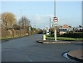
2009 : Roundabout on Semington Road
Approaching Berryfield.
The roundabout is at the entrance to the new business park. Heavy vehicles exit onto the bypass about 600 yards to the east.
Image: © Maurice Pullin
Taken: 6 Dec 2009
0.22 miles
10
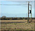
2009 : Power line posts with phase splitter
Reduces 3 phase electrical power to single phase for local use.
High voltage lines and a pylon are seen in the distance. Beyond that a factory chimney which is at Staverton.
Looks like maize stubble in the field.
Image: © Maurice Pullin
Taken: 6 Dec 2009
0.25 miles