
IMAGES TAKEN NEAR TO
Berryfield Lane, MELKSHAM, SN12 6EH
Introduction
This page details the photographs taken nearby to Berryfield Lane, SN12 6EH by members of the Geograph project.
The Geograph project started in 2005 with the aim of publishing, organising and preserving representative images for every square kilometre of Great Britain, Ireland and the Isle of Man.

There are currently over 7.5m images from over14,400 individuals and you can help contribute to the project by visiting https://www.geograph.org.uk
Image Map
Images are licensed for reuse under creativecommons.org/licenses/by-sa/2.0
Notes
- Clicking on the map will re-center to the selected point.
- The higher the marker number, the further away the image location is from the centre of the postcode.
Image Listing (7 Images Found)
Images are licensed for reuse under creativecommons.org/licenses/by-sa/2.0
Image
Details
Distance
1
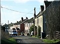
2008 : The turn on Berryfield Lane near Melksham
Some rather pleasant old houses on Berryfield Lane. The road ahead leads to Holbrook Farm.
Image: © Maurice Pullin
Taken: 1 Feb 2008
0.03 miles
2
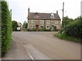
Berryfield Cottages
The one listed building in Berryfield, this pair of cottages is described as a "good example of stone late C18 artisan dwelling in unaltered condition" http://www.britishlistedbuildings.co.uk/en-314394-berryfields-cottages-612-and-613-melksha .
Image: © Derek Harper
Taken: 20 Jul 2011
0.03 miles
3
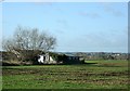
2008 : Outbuildings at Berryfield near Melksham
At this time of year it is not easy to tell wheat from newly sown grass, this is wheat (I think).
Beyond the field we are looking west toward Holt.
Image: © Maurice Pullin
Taken: 1 Feb 2008
0.04 miles
4
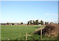
2008 : Boundary Farm near Melksham
Looking across a pasture to the outbuildings of Boundary Farm, the roof of the farmhouse is on the right.
Image: © Maurice Pullin
Taken: 1 Feb 2008
0.17 miles
6
2008 : Berryfield Lane near Melksham
The farmhouse at Boundary Farm.
Image: © Maurice Pullin
Taken: 1 Feb 2008
0.18 miles
7
Green, Berryfield
A trinagular green between the fork of Berryfield Lane (left) and Berryfield Park.
Image: © Derek Harper
Taken: 20 Jul 2011
0.22 miles