
IMAGES TAKEN NEAR TO
The Close, MELKSHAM, SN12 6AG
Introduction
This page details the photographs taken nearby to The Close, SN12 6AG by members of the Geograph project.
The Geograph project started in 2005 with the aim of publishing, organising and preserving representative images for every square kilometre of Great Britain, Ireland and the Isle of Man.

There are currently over 7.5m images from over14,400 individuals and you can help contribute to the project by visiting https://www.geograph.org.uk
Image Map
Images are licensed for reuse under creativecommons.org/licenses/by-sa/2.0
Notes
- Clicking on the map will re-center to the selected point.
- The higher the marker number, the further away the image location is from the centre of the postcode.
Image Listing (34 Images Found)
Images are licensed for reuse under creativecommons.org/licenses/by-sa/2.0
Image
Details
Distance
1
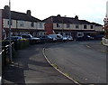
Warwick Crescent houses in Melksham
Viewed from the Spa Road end looking towards Kenilworth Gardens.
Image: © Jaggery
Taken: 5 Nov 2014
0.06 miles
2
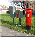
King George VI postbox on a corner in Melksham
Located here. http://www.geograph.org.uk/photo/4237765
Image: © Jaggery
Taken: 5 Nov 2014
0.10 miles
3
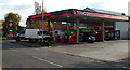
Texaco and Spar, Spa Road, Melksham
Filling station and shop.
Image: © Jaggery
Taken: 5 Nov 2014
0.11 miles
4
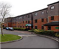
Wharf Court, Melksham
Retirement/sheltered housing containing 76 flats, built in 1991 on the south side of Spa Road.
Image: © Jaggery
Taken: 5 Nov 2014
0.12 miles
5
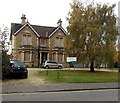
Boarded up building on the south side of Spa Road, Melksham
All the windows in view are boarded up in early November 2014.
The Wiltshire Council board shows Development Centre for Young People.
Image: © Jaggery
Taken: 5 Nov 2014
0.13 miles
6
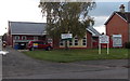
Canberra Children's Centre in Melksham
The recently-built Children's Centre on the south side of Spa Road replaced
its worn out predecessor shown on a Google Earth Street View taken in July 2009.
Image: © Jaggery
Taken: 5 Nov 2014
0.13 miles
7
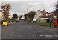
Coronation Road, Melksham
Viewed across Spa Road. The yellow temporary sign on the left gives details of road closures
later in the month. The red postbox is from the reign of King George VI. http://www.geograph.org.uk/photo/4237771
Image: © Jaggery
Taken: 5 Nov 2014
0.15 miles
8
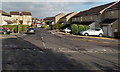
Rope Walk, Melksham
Cul-de-sac on the NE side of Spa Road.
Image: © Jaggery
Taken: 5 Nov 2014
0.15 miles
10
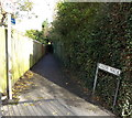
Hardie Walk, Melksham
Viewed from Spa Road. Below the No Cycling sign, a blue sign pointing along Hardie Walk shows
Lost Waterway of Melksham
Town Walk.
Image: © Jaggery
Taken: 5 Nov 2014
0.16 miles