
IMAGES TAKEN NEAR TO
Thatcham Close, CALNE, SN11 9UR
Introduction
This page details the photographs taken nearby to Thatcham Close, SN11 9UR by members of the Geograph project.
The Geograph project started in 2005 with the aim of publishing, organising and preserving representative images for every square kilometre of Great Britain, Ireland and the Isle of Man.

There are currently over 7.5m images from over14,400 individuals and you can help contribute to the project by visiting https://www.geograph.org.uk
Image Map
Images are licensed for reuse under creativecommons.org/licenses/by-sa/2.0
Notes
- Clicking on the map will re-center to the selected point.
- The higher the marker number, the further away the image location is from the centre of the postcode.
Image Listing (15 Images Found)
Images are licensed for reuse under creativecommons.org/licenses/by-sa/2.0
Image
Details
Distance
1
2011 : School Road, north west Calne
A recent development off the Calne bypass.
Image: © Maurice Pullin
Taken: 19 Apr 2011
0.11 miles
2
2011 : A3102 Greenacres Way, Calne bypass
A fairly new bypass north west of Calne.
School Road leaves to the right at the roundabout.
Image: © Maurice Pullin
Taken: 19 Apr 2011
0.14 miles
3
2011 : A3102 and waste collection vehicle
On the Calne bypass, entering the roundabout at the end of School Road.
Image: © Maurice Pullin
Taken: 19 Apr 2011
0.15 miles
4
A3102 roundabout south of Lickhill Farm
This could be a by-pass or ring road around hundreds of country towns. Traffic congestion in the ancient town centre has led to pressure for a relief road. In some distant council office a planner draws a line on the map, which becomes the de facto town perimeter. Everything inside the perimeter is filled with new housing, motorists whiz around the periphery; everybody's happy...?
Image: © Stuart Logan
Taken: 16 May 2012
0.16 miles
5
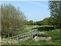
2011 : Storm ditch by the A3102 Calne bypass
Image: © Maurice Pullin
Taken: 19 Apr 2011
0.17 miles
6
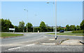
2011 : A3102 roundabout on the Calne bypass
North west of Calne, School Road leaves to the right.
The buildings beyond are part of Lickhill Farm.
Image: © Maurice Pullin
Taken: 19 Apr 2011
0.19 miles
7
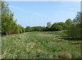
2011 : Field near the A3102 Calne bypass
Lickhill Farm is a few hundred yards to the right.
Image: © Maurice Pullin
Taken: 19 Apr 2011
0.20 miles
8
![A walk around Calne [13]](https://s3.geograph.org.uk/geophotos/06/76/22/6762231_4a5e4f6d_120x120.jpg)
A walk around Calne [13]
The path runs along the rear fence of the houses in Braemor Road.
From the town centre the route leads through mostly modern housing before meeting open countryside after crossing the recently built A3102. After passing Calne Sewage Works and crossing both the abandoned Wilts and Berks canal and the River Marden the route joins the dismantled Calne Branch railway which is followed back to the town centre where it crosses the canal again. About 3½ miles.
Image: © Michael Dibb
Taken: 7 Oct 2020
0.20 miles
9
![A walk around Calne [14]](https://s0.geograph.org.uk/geophotos/06/76/22/6762232_a8327ead_120x120.jpg)
A walk around Calne [14]
The path crosses Woodsage Way.
From the town centre the route leads through mostly modern housing before meeting open countryside after crossing the recently built A3102. After passing Calne Sewage Works and crossing both the abandoned Wilts and Berks canal and the River Marden the route joins the dismantled Calne Branch railway which is followed back to the town centre where it crosses the canal again. About 3½ miles.
Image: © Michael Dibb
Taken: 7 Oct 2020
0.21 miles
10
![A walk around Calne [12]](https://s2.geograph.org.uk/geophotos/06/76/22/6762230_502e9b40_120x120.jpg)
A walk around Calne [12]
Springfield Drive is a street of typical, bland, modern houses.
From the town centre the route leads through mostly modern housing before meeting open countryside after crossing the recently built A3102. After passing Calne Sewage Works and crossing both the abandoned Wilts and Berks canal and the River Marden the route joins the dismantled Calne Branch railway which is followed back to the town centre where it crosses the canal again. About 3½ miles.
Image: © Michael Dibb
Taken: 7 Oct 2020
0.22 miles