IMAGES TAKEN NEAR TO
Meadow View, CALNE, SN11 0ST
Introduction
This page details the photographs taken nearby to Meadow View, SN11 0ST by members of the Geograph project.
The Geograph project started in 2005 with the aim of publishing, organising and preserving representative images for every square kilometre of Great Britain, Ireland and the Isle of Man.

There are currently over 7.5m images from over14,400 individuals and you can help contribute to the project by visiting https://www.geograph.org.uk
Image Map
Images are licensed for reuse under creativecommons.org/licenses/by-sa/2.0
Notes
- Clicking on the map will re-center to the selected point.
- The higher the marker number, the further away the image location is from the centre of the postcode.
Image Listing (12 Images Found)
Images are licensed for reuse under creativecommons.org/licenses/by-sa/2.0
Image
Details
Distance
1
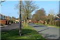
2012 : Minor road to Calne and Rookery Park
Two for the price of one.
Rookery Park is to the left.
Image: © Maurice Pullin
Taken: 11 Mar 2012
0.02 miles
2
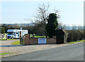
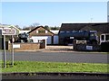
2012 : Motor Museum at Quemerford
Closing in on Image] taken in 2006, we can now see the opening times in the larger image. (click on "more sizes" top right)
Unfortunately was unable to visit as the museum http://atwellwilson.org.uk/ does not open until 1st April.
Image: © Maurice Pullin
Taken: 11 Mar 2012
0.07 miles
3
2012 : Motor Museum at Quemerford not the way in
Closing in on Image] taken in 2006, we can take a closer look at the exit.
Unfortunately was unable to visit as the museum http://atwellwilson.org.uk/ does not open until 1st April.
Image: © Maurice Pullin
Taken: 11 Mar 2012
0.07 miles
4
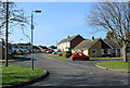
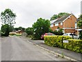
2012 : Fairway, Quemerford
A pleasant residential road on the edge of Calne.
Image: © Maurice Pullin
Taken: 11 Mar 2012
0.07 miles
5
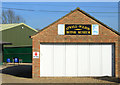
Atwell-Wilson Motor Museum
Behind the unassuming entrance is a large collection of cars, some unique.
The photographer recently hired one to take his daughter to her wedding.
Image: © Chris Henley
Taken: 9 Nov 2006
0.08 miles
6
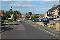
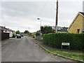
The Rise, Calne
Near the southern edge of Quemerford.
Image: © Andrew Smith
Taken: 2 Jul 2023
0.15 miles
9
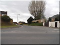
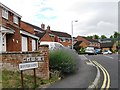
Stockley Lane at the junction of Quemerford
Image: © David Howard
Taken: 24 Apr 2016
0.19 miles