
IMAGES TAKEN NEAR TO
Tyning Park, CALNE, SN11 0QF
Introduction
This page details the photographs taken nearby to Tyning Park, SN11 0QF by members of the Geograph project.
The Geograph project started in 2005 with the aim of publishing, organising and preserving representative images for every square kilometre of Great Britain, Ireland and the Isle of Man.

There are currently over 7.5m images from over14,400 individuals and you can help contribute to the project by visiting https://www.geograph.org.uk
Image Map
Images are licensed for reuse under creativecommons.org/licenses/by-sa/2.0
Notes
- Clicking on the map will re-center to the selected point.
- The higher the marker number, the further away the image location is from the centre of the postcode.
Image Listing (29 Images Found)
Images are licensed for reuse under creativecommons.org/licenses/by-sa/2.0
Image
Details
Distance
1
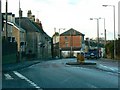
Wessington Avenue, Calne
At the left Bentley Lane can be seen joining what is better known as the A4, the old coaching road from London to the West.
Image: © Brian Robert Marshall
Taken: 10 Dec 2008
0.08 miles
2
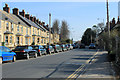
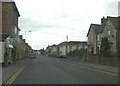
2012 : A4 heading east out of Calne
Near the end of London Road, a little further on the A4 becomes Wessington Avenue.
The housing appears to be late Victorian or Edwardian.
Image: © Maurice Pullin
Taken: 11 Mar 2012
0.08 miles
3
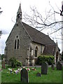
QUEMERFORD, Calne, Wiltshire
The Victorian church of Holy Trinity
Image: © ChurchCrawler
Taken: 19 Jul 2004
0.09 miles
5
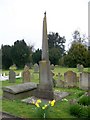
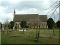
Monument, Holy Trinity Church, Quemerford
A very interesting monument within the churchyard.
Image: © Maigheach-gheal
Taken: 11 Apr 2010
0.09 miles
6
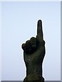
Pointing to the sky, Holy Trinity Churchyard
The top of a churchyard monument. For a wider view Image
Image: © Maigheach-gheal
Taken: 11 Apr 2010
0.09 miles
8
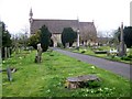
Holy Trinity Church, Quemerford
The church on London Road, was built in 1867 of coursed and squared limestone rubble.
Image: © Maigheach-gheal
Taken: 11 Apr 2010
0.10 miles
9
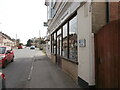
The A4 passes through Calne
On the right is T K Tackle https://tktackle.co.uk/ , a shop selling fishing equipment. Beyond it is the site of the former petrol station seen in Image and Image, now demolished.
Image: © HelenK
Taken: 1 Apr 2021
0.11 miles
10
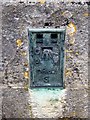
Flush Bracket S0862, Holy Trinity Church
The flush bracket is on the southwest angle of the church. For a wider view of the church Image and http://www.bench-marks.org.uk/bm21173
A bench mark is an Ordnance Survey arrowhead sign found on walls, bridges, churches and specially erected triangulation pillars where the altitude above sea-level has been accurately measured by surveyors. The arrowhead points to a horizontal line above it which marks the exact altitude.
With rivets and pivots there is no datum (horizontal line) cut, the pointed-to horizontal surface defining the datum height.
Image: © Maigheach-gheal
Taken: 11 Apr 2010
0.11 miles