
IMAGES TAKEN NEAR TO
Curzon Street, CALNE, SN11 0DG
Introduction
This page details the photographs taken nearby to Curzon Street, SN11 0DG by members of the Geograph project.
The Geograph project started in 2005 with the aim of publishing, organising and preserving representative images for every square kilometre of Great Britain, Ireland and the Isle of Man.

There are currently over 7.5m images from over14,400 individuals and you can help contribute to the project by visiting https://www.geograph.org.uk
Image Map
Images are licensed for reuse under creativecommons.org/licenses/by-sa/2.0
Notes
- Clicking on the map will re-center to the selected point.
- The higher the marker number, the further away the image location is from the centre of the postcode.
Image Listing (110 Images Found)
Images are licensed for reuse under creativecommons.org/licenses/by-sa/2.0
Image
Details
Distance
1
![A walk around Calne [7]](https://s3.geograph.org.uk/geophotos/06/76/22/6762203_e2986511_120x120.jpg)
A walk around Calne [7]
On Curzon Street, (A4) are this pair of attractive houses.
From the town centre the route leads through mostly modern housing before meeting open countryside after crossing the recently built A3102. After passing Calne Sewage Works and crossing both the abandoned Wilts and Berks canal and the River Marden the route joins the dismantled Calne Branch railway which is followed back to the town centre where it crosses the canal again. About 3½ miles.
Image: © Michael Dibb
Taken: 7 Oct 2020
0.01 miles
2
![A walk around Calne [8]](https://s0.geograph.org.uk/geophotos/06/76/22/6762204_7c55001d_120x120.jpg)
A walk around Calne [8]
Curzon House, 54 Curzon Street is a mid 19th century house in ashlar with the gable end wall rendered. Listed, grade II, with details at: https://historicengland.org.uk/listing/the-list/list-entry/1247122
From the town centre the route leads through mostly modern housing before meeting open countryside after crossing the recently built A3102. After passing Calne Sewage Works and crossing both the abandoned Wilts and Berks canal and the River Marden the route joins the dismantled Calne Branch railway which is followed back to the town centre where it crosses the canal again. About 3½ miles.
Image: © Michael Dibb
Taken: 7 Oct 2020
0.02 miles
3
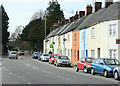
2010 : A4 Curzon Street, Calne
A terrace of smart houses on Curzon Street, one for sale another already sold.
Heading west out of Calne to Derry Hill and Chippenham.
Image: © Maurice Pullin
Taken: 16 Apr 2010
0.05 miles
4
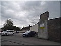
Car dealership on Curzon Street, Calne
It says Coopers on the old wall so is probably still them, there are no other signs about.
Image: © David Howard
Taken: 24 Apr 2016
0.05 miles
6
![A walk around Calne [9]](https://s2.geograph.org.uk/geophotos/06/76/22/6762210_95bc0d4e_120x120.jpg)
A walk around Calne [9]
From Curzon Street a footpath runs alongside the cemetery to Springfield Drive.
From the town centre the route leads through mostly modern housing before meeting open countryside after crossing the recently built A3102. After passing Calne Sewage Works and crossing both the abandoned Wilts and Berks canal and the River Marden the route joins the dismantled Calne Branch railway which is followed back to the town centre where it crosses the canal again. About 3½ miles.
Image: © Michael Dibb
Taken: 7 Oct 2020
0.08 miles
7
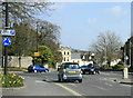
2010 : A4 Roundabout on Curzon Street, Calne
The road to the left was formerly the A3102 to Lyneham which is now routed via a bypass. Believe the A4 is soon to join it if not already done so.
Image: © Maurice Pullin
Taken: 16 Apr 2010
0.12 miles
8
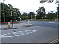
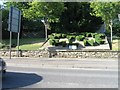
Calne in Bloom
On this August evening central Calne was adorned with striking displays of flowers in beds (seen here on either side of Curzon St) and hanging baskets (one of which is just visible). The town council is proud of this initiative and has won awards in the RHS South West in Bloom competition. https://www.calne.gov.uk/calne-in-bloom/
Image: © HelenK
Taken: 13 Aug 2021
0.12 miles
10
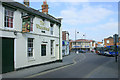
2010 : The Wheatsheaf, Oxford Road, Calne
Near the junction of Oxford Road and the A4.
A Lyneham to Chippenham bus pulls into the stop, a shopping arcade is behind it.
The Wheatsheaf can be found on various websites.
Image: © Maurice Pullin
Taken: 16 Apr 2010
0.13 miles