1
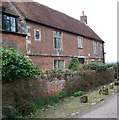
The Bell, Great Cheverell
A large brick pub of about 1740. The pub has recently been featured on the TV programme Relocation Relocation.
Image: © Maigheach-gheal
Taken: 22 Feb 2008
0.01 miles
2
The Bell public house at Great Cheverell, Wiltshire
The Bell, Great Cheverell, Wiltshire. An inn since the 17th century, this grade II listed traditional coaching inn now boasts three luxury en-suite bedrooms, a restaurant & bar. According to the pub's website, the property was recorded in Domesday Book, and since 1740 was frequented by cattle drovers.
Image: © James Harrison
Taken: 1 Nov 2016
0.01 miles
3
Houses in Great Cheverell [15]
Originally a farmhouse, Glebe House in Church Road is late 17th and early 18th century. Listed, grade II, with details at: https://www.historicengland.org.uk/listing/the-list/list-entry/1182075
Image: © Michael Dibb
Taken: 12 Sep 2017
0.02 miles
4
Parish church [3]
Old gravestones have been used to create edging to the path in the churchyard. Several monuments in the yard are listed.
Image: © Michael Dibb
Taken: 12 Sep 2017
0.02 miles
5
The Bell Inn
Looking very attractive with many floral displays, the inn is late 18th century. The inn is listed, grade II, with details at: https://www.historicengland.org.uk/listing/the-list/list-entry/1035794
Image: © Michael Dibb
Taken: 12 Sep 2017
0.02 miles
6
The Glebe House, Great Cheverell
Built in about 1700. It is the former farmhouse of the rectory lands.
Image: © Maigheach-gheal
Taken: 22 Feb 2008
0.03 miles
7
The Old Rectory
Seen from Church Road, the Old Rectory was built in 1844 and is listed, grade II, with details at: https://www.historicengland.org.uk/listing/the-list/list-entry/1182067
Image: © Michael Dibb
Taken: 12 Sep 2017
0.03 miles
8
Houses in Great Cheverell [14]
Number 2 Church Road was built circa 1840. The house, together with the front garden wall and railings, is listed, grade II, with details at: https://www.historicengland.org.uk/listing/the-list/list-entry/1035790
Image: © Michael Dibb
Taken: 12 Sep 2017
0.03 miles
9
Ordnance Survey Cut Mark
The mark can be found on the wall of The Bell PH in Great Cheverell.
For more detail see : http://www.bench-marks.org.uk/bm83506
Image: © Peter Wood
Taken: 16 Feb 2017
0.03 miles
10
Parish church [2]
The church of St Peter dates back to the 11th century with later additions and alteration in the 13th, 14th and 15th centuries. The tower is 14th century and the clock is reputed to be from 1629. The church was restored in 1868 and is listed, grade I, with details at: https://www.historicengland.org.uk/listing/the-list/list-entry/1035786 The railings and gateway are also listed, grade II, with details at: https://www.historicengland.org.uk/listing/the-list/list-entry/1364654
Image: © Michael Dibb
Taken: 12 Sep 2017
0.04 miles


![Houses in Great Cheverell [15]](https://s0.geograph.org.uk/geophotos/05/57/46/5574660_bed843d5_120x120.jpg)
![Parish church [3]](https://s1.geograph.org.uk/geophotos/05/57/50/5575017_0d7f1693_120x120.jpg)


![Houses in Great Cheverell [14]](https://s2.geograph.org.uk/geophotos/05/57/46/5574654_e17de526_120x120.jpg)

![Parish church [2]](https://s3.geograph.org.uk/geophotos/05/57/50/5575015_37384aa9_120x120.jpg)