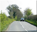
IMAGES TAKEN NEAR TO
Cheverell Road, DEVIZES, SN10 5UJ

Introduction

This page details the photographs taken nearby to Cheverell Road, SN10 5UJ by members of the Geograph project.

The Geograph project started in 2005 with the aim of publishing, organising and preserving representative images for every square kilometre of Great Britain, Ireland and the Isle of Man.

There are currently over 7.5m images from over14,400 individuals and you can help contribute to the project by visiting https://www.geograph.org.uk

Image Map


Images are licensed for reuse under creativecommons.org/licenses/by-sa/2.0
Notes
  • Clicking on the map will re-center to the selected point.
  • The higher the marker number, the further away the image location is from the centre of the postcode.

Image Listing (17 Images Found)

Images are licensed for reuse under creativecommons.org/licenses/by-sa/2.0
Image
Details
Distance
1
Cattle grazing at Cuckold's Green
Although this is identified as Cuckold's Green, Worton seems to be gradually spreading eastwards and this is effectively the first section of farmland adjacent to the road at the eastern end of the village.
Image: © Doug Lee Taken: 8 Jul 2006
0.04 miles
2
Hedge cutting, Cuckhold's Green
Hedge cutting taking place after the baby birds have flown.
Image: © Maigheach-gheal Taken: 27 Jul 2009
0.06 miles
3
2009 : Worton begins here
Or ends if you are going the other way.
Image: © Maurice Pullin Taken: 20 Apr 2009
0.07 miles
4
2009 : Minor road near Worton
Having left Worton our minor road heads south to the A360.
Image: © Maurice Pullin Taken: 20 Apr 2009
0.07 miles
5
Gate and footpath, Cuckhold's Green
The footpath takes walkers from the minor road at Cuckhold's Green into the village of Worton.
Image: © Maigheach-gheal Taken: 27 Jul 2009
0.09 miles
6
Stile, Cuckhold's Green
Roughly hewn steps take you up the high bank to gain access to the footpath that takes walkers from Cuckhold's Green to Ware Farm and the A360.
Image: © Maigheach-gheal Taken: 27 Jul 2009
0.11 miles
7
Worton Road
From Worton to Potterne.
Image: © Robin Webster Taken: 21 Aug 2016
0.11 miles
8
The end of the road
The road called Sandleaze ends at the gate. The public footpath runs across between the two gates. Wroton playing field is beyond the second gate.
Image: © Michael Dibb Taken: 23 Dec 2017
0.16 miles
9
Bus shelter
The shelter is at the junction of High Street and Sandleaze.
Image: © Michael Dibb Taken: 22 Oct 2016
0.16 miles
10
Growing well
A productive plot on Sandleaze, Worton.
Image: © Michael Dibb Taken: 22 Oct 2016
0.16 miles