IMAGES TAKEN NEAR TO
Five Lanes, DEVIZES, SN10 5TE

Introduction

This page details the photographs taken nearby to Five Lanes, SN10 5TE by members of the Geograph project.

The Geograph project started in 2005 with the aim of publishing, organising and preserving representative images for every square kilometre of Great Britain, Ireland and the Isle of Man.

There are currently over 7.5m images from over14,400 individuals and you can help contribute to the project by visiting https://www.geograph.org.uk

Image Map


Images are licensed for reuse under creativecommons.org/licenses/by-sa/2.0
Notes
  • Clicking on the map will re-center to the selected point.
  • The higher the marker number, the further away the image location is from the centre of the postcode.

Image Listing (5 Images Found)

Images are licensed for reuse under creativecommons.org/licenses/by-sa/2.0
Image
Details
Distance
1
The Mill School
A former textile mill, mentioned in the Domesday Book. The present building is eighteenth century.
Image: © Chris Henley Taken: 25 Sep 2006
0.11 miles
2
2009 : Looking south near Whistley Farm
Image: © Maurice Pullin Taken: 20 Apr 2009
0.19 miles
3
Wiltshire farmland
Seen from Whistley Road.
Image: © Michael Dibb Taken: 8 Dec 2014
0.22 miles
4
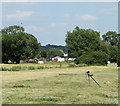
2010 : Mysterious object off Hay Lane
Looking toward By The Mill Farm. It was the thing in the foreground that took my interest, looks like a camera falling off a tripod, turned out to be a metal detector. The owner had found a spent cartridge case with the side blown out, probably caused by a fire, it was of the type used by the USAF during WWII. They had a base at nearby Keevil Airfield.
Image: © Maurice Pullin Taken: 26 Jun 2010
0.23 miles
5
2010 : Fields adjacent to one of the Five Lanes
The one that goes to Poulshot. Mowing grass left to dry in the sun, probably for hay. The view between the trees is toward Devizes.
Image: © Maurice Pullin Taken: 26 Jun 2010
0.25 miles