1
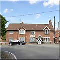
Potterne: Danger, Sharp Turn
An old road sign on the wall of the facing house at
Image There are red reflector studs embedded into the lettering of the word DANGER, and white ones in the SHARP TURN and in the arrow.
Image: © Chris Downer
Taken: 4 Apr 2009
0.02 miles
2
Potterne buildings [7]
Now a private house, The Old Chapel, is in Mill Road. Built in 1859 as a Wesleyan Methodist Reform Chapel.
The village of Potterne is 2 miles south of Devizes. It lies astride the A360 road which is the main road to Salisbury and one of the few roads across Salisbury Plain. The Domesday Book of 1086 recorded three landholdings at Potterne, with six mills and a large population of 107 households. Until 2016, Potterne was the headquarters of the Wiltshire Fire and Rescue Service.
Image: © Michael Dibb
Taken: 16 Mar 2020
0.02 miles
3
Potterne: parish church of St. Mary
The church occupies the inside corner of Church Corner, across which we are looking as two cars negotiate the sharp right turn at the top of the hill.
Image: © Chris Downer
Taken: 4 Apr 2009
0.03 miles
4
Potterne
Timber framed cottages dating from circa 1600.
Image: © Maigheach-gheal
Taken: 25 Apr 2007
0.03 miles
5
Potterne houses [25]
Number 1 Duck Street, Packway House, is an early 19th century remodelling of a 17th or 18th century range. The various building phases are indicated by the straight joints in the rubblestone and the brick. Listed, grade II, with details at: https://historicengland.org.uk/listing/the-list/list-entry/1273284
The village of Potterne is 2 miles south of Devizes. It lies astride the A360 road which is the main road to Salisbury and one of the few roads across Salisbury Plain. The Domesday Book of 1086 recorded three landholdings at Potterne, with six mills and a large population of 107 households. Until 2016, Potterne was the headquarters of the Wiltshire Fire and Rescue Service.
Image: © Michael Dibb
Taken: 16 Mar 2020
0.03 miles
6
Parish church [8]
The view from the churchyard of the church of St Mary, looking towards Trowbridge is stunning. There are a dozen listed memorials within the yard.
The church of St Mary is a beautifully proportioned and complete church in the Early English style. The building is entirely 13th century with the exception of a 14th century porch and a 15th century additional storey to the tower. The church was restored in 1872. There are many items of interest including an Anglo Saxon font from the 9th century and Purbeck Marble columns on the east window. Listed, grade I, with details at: https://historicengland.org.uk/listing/the-list/list-entry/1258968
The village of Potterne is 2 miles south of Devizes. It lies astride the A360 road which is the main road to Salisbury and one of the few roads across Salisbury Plain. The Domesday Book of 1086 recorded three landholdings at Potterne, with six mills and a large population of 107 households. Until 2016, Potterne was the headquarters of the Wiltshire Fire and Rescue Service.
Image: © Michael Dibb
Taken: 16 Mar 2020
0.03 miles
7
Potterne: Church Corner
Following the A360 southward, The Butts becomes Eastwell Road at this sharp bend with the church on the left-hand side. The 'Danger, Sharp Turn' sign is an old one, which has reflector studs incorporated into the lettering and arrow.
Image: © Chris Downer
Taken: 4 Apr 2009
0.03 miles
8
Danger Sharp Turn
Image: © Anthony Parkes
Taken: 2 Aug 2021
0.03 miles
9
House with a warning sign, Potterne
The sign is official, and has reflectors incorporated
Image
Image: © David Smith
Taken: 1 Jun 2017
0.03 miles
10
Potterne features [1]
This sign is on the wall of a house at the bottom of Church Corner. There is a steep descent to a 90 degree left turn into High Street.
The village of Potterne is 2 miles south of Devizes. It lies astride the A360 road which is the main road to Salisbury and one of the few roads across Salisbury Plain. The Domesday Book of 1086 recorded three landholdings at Potterne, with six mills and a large population of 107 households. Until 2016, Potterne was the headquarters of the Wiltshire Fire and Rescue Service.
Image: © Michael Dibb
Taken: 12 Sep 2017
0.03 miles


![Potterne buildings [7]](https://s3.geograph.org.uk/geophotos/06/45/52/6455215_2193dfa3_120x120.jpg)


![Potterne houses [25]](https://s0.geograph.org.uk/geophotos/06/45/52/6455264_04bb54a5_120x120.jpg)
![Parish church [8]](https://s2.geograph.org.uk/geophotos/06/45/31/6453118_3f7ab2c4_120x120.jpg)


![Potterne features [1]](https://s2.geograph.org.uk/geophotos/05/57/57/5575750_d3c93f99_120x120.jpg)