
IMAGES TAKEN NEAR TO
High Street, DEVIZES, SN10 5NA
Introduction
This page details the photographs taken nearby to High Street, SN10 5NA by members of the Geograph project.
The Geograph project started in 2005 with the aim of publishing, organising and preserving representative images for every square kilometre of Great Britain, Ireland and the Isle of Man.

There are currently over 7.5m images from over14,400 individuals and you can help contribute to the project by visiting https://www.geograph.org.uk
Image Map
Images are licensed for reuse under creativecommons.org/licenses/by-sa/2.0
Notes
- Clicking on the map will re-center to the selected point.
- The higher the marker number, the further away the image location is from the centre of the postcode.
Image Listing (190 Images Found)
Images are licensed for reuse under creativecommons.org/licenses/by-sa/2.0
Image
Details
Distance
2
![Potterne houses [14]](https://s0.geograph.org.uk/geophotos/06/45/29/6452948_7591cc53_120x120.jpg)
Potterne houses [14]
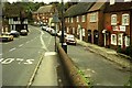
This row of three houses, numbers 23, 24 and 25 High Street, are late 18th century in red brick. Numbers 23 and 24 are a symmetrical pair whilst number 25, under the same roof, had different fenestration. Listed, grade II, with details at: https://historicengland.org.uk/listing/the-list/list-entry/1273046
The village of Potterne is 2 miles south of Devizes. It lies astride the A360 road which is the main road to Salisbury and one of the few roads across Salisbury Plain. The Domesday Book of 1086 recorded three landholdings at Potterne, with six mills and a large population of 107 households. Until 2016, Potterne was the headquarters of the Wiltshire Fire and Rescue Service.
Image: © Michael Dibb
Taken: 16 Mar 2020
0.01 miles
3
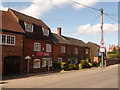
Potterne: the post office
The village stores, just at the point where Duck Street comes out acutely onto the main road.
Image: © Chris Downer
Taken: 4 Apr 2009
0.01 miles
4
![Potterne houses [1]](https://s3.geograph.org.uk/geophotos/05/57/57/5575779_4388d3ca_120x120.jpg)
Potterne houses [1]
Once an inn, The Old King's Arms, this 18th century house is brick built with a thatched roof. Listed, grade II, with details at: https://www.historicengland.org.uk/listing/the-list/list-entry/1243103 There is another view at Image
The village of Potterne is 2 miles south of Devizes. It lies astride the A360 road which is the main road to Salisbury and one of the few roads across Salisbury Plain. The Domesday Book of 1086 recorded three landholdings at Potterne, with six mills and a large population of 107 households. Until 2016, Potterne was the headquarters of the Wiltshire Fire and Rescue Service.
Image: © Michael Dibb
Taken: 12 Sep 2017
0.01 miles
5
![Potterne houses [2]](https://s1.geograph.org.uk/geophotos/06/45/27/6452717_6af98312_120x120.jpg)
Potterne houses [2]
Once an inn, The Old King's Arms, this 18th century house is brick built with a thatched roof. Listed, grade II, with details at: https://www.historicengland.org.uk/listing/the-list/list-entry/1243103 There is another view at Image
The village of Potterne is 2 miles south of Devizes. It lies astride the A360 road which is the main road to Salisbury and one of the few roads across Salisbury Plain. The Domesday Book of 1086 recorded three landholdings at Potterne, with six mills and a large population of 107 households. Until 2016, Potterne was the headquarters of the Wiltshire Fire and Rescue Service.
Image: © Michael Dibb
Taken: 16 Mar 2020
0.01 miles
6
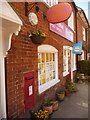
Potterne: postbox № SN10 46, Eastwell Road
This Elizabeth II-reign postbox is set into the wall of Image and is emptied finally at 4:45pm on weekdays and at 11:30am on Saturdays.
Image: © Chris Downer
Taken: 4 Apr 2009
0.01 miles
7
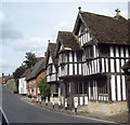
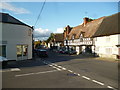
Potterne Village
Timbered framed house built circa 1480.
Image: © Maigheach-gheal
Taken: 25 Apr 2007
0.01 miles
9
![Potterne houses [5]](https://s1.geograph.org.uk/geophotos/05/57/57/5575745_5939ed3c_120x120.jpg)
Potterne houses [5]
This magnificent house, Porch House, number 6 High Street, from circa 1480 was extensively restored in 1872-76. At one time (18th century) it was a public house 'The Pack Horse' and it has also been divided into cottages. Many original internal features remain as do many from the restoration. Listed, grade I, there is much detail and history at: https://www.historicengland.org.uk/listing/the-list/list-entry/1273182 There is another view at Image
The village of Potterne is 2 miles south of Devizes. It lies astride the A360 road which is the main road to Salisbury and one of the few roads across Salisbury Plain. The Domesday Book of 1086 recorded three landholdings at Potterne, with six mills and a large population of 107 households. Until 2016, Potterne was the headquarters of the Wiltshire Fire and Rescue Service.
Image: © Michael Dibb
Taken: 12 Sep 2017
0.01 miles
10
![Potterne houses [6]](https://s3.geograph.org.uk/geophotos/06/45/27/6452719_e3f4b5d0_120x120.jpg)
Potterne houses [6]
This magnificent house, Porch House, number 6 High Street, from circa 1480 was extensively restored in 1872-76. At one time (18th century) it was a public house 'The Pack Horse' and it has also been divided into cottages. Many original internal features remain as do many from the restoration. Listed, grade I, there is much detail and history at: https://www.historicengland.org.uk/listing/the-list/list-entry/1273182 There is another view at Image
The village of Potterne is 2 miles south of Devizes. It lies astride the A360 road which is the main road to Salisbury and one of the few roads across Salisbury Plain. The Domesday Book of 1086 recorded three landholdings at Potterne, with six mills and a large population of 107 households. Until 2016, Potterne was the headquarters of the Wiltshire Fire and Rescue Service.
Image: © Michael Dibb
Taken: 16 Mar 2020
0.01 miles