
IMAGES TAKEN NEAR TO
Kings Road, DEVIZES, SN10 4PX
Introduction
This page details the photographs taken nearby to Kings Road, SN10 4PX by members of the Geograph project.
The Geograph project started in 2005 with the aim of publishing, organising and preserving representative images for every square kilometre of Great Britain, Ireland and the Isle of Man.

There are currently over 7.5m images from over14,400 individuals and you can help contribute to the project by visiting https://www.geograph.org.uk
Image Map
Images are licensed for reuse under creativecommons.org/licenses/by-sa/2.0
Notes
- Clicking on the map will re-center to the selected point.
- The higher the marker number, the further away the image location is from the centre of the postcode.
Image Listing (16 Images Found)
Images are licensed for reuse under creativecommons.org/licenses/by-sa/2.0
Image
Details
Distance
1
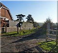
Byway leaves the road
From Kings Road, this track, a designated byway runs to the High Street in Market Lavington.
Image: © Michael Dibb
Taken: 3 Dec 2014
0.02 miles
2
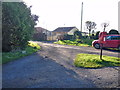
Byway meets road
As Kings Road takes a 90 degree bend, it meets Oak Lane. A designated byway, Oak Lane is a track but becomes a public road after some 200 metres.
Image: © Michael Dibb
Taken: 3 Dec 2014
0.02 miles
3
![Four ways to go [2]](https://s1.geograph.org.uk/geophotos/04/26/63/4266393_387df8d3_120x120.jpg)
Four ways to go [2]
At this junction, Kings Road makes a 90 degree bend, a byway (Vicarage Lane) begins and there is a drive to Easterton House. This is Kings Road looking south west towards Ledge Hill.
Image: © Michael Dibb
Taken: 3 Dec 2014
0.09 miles
4
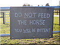
You have been warned
A sign on a gate alongside Kings Road.
Image: © Michael Dibb
Taken: 3 Dec 2014
0.09 miles
5
![Four ways to go [3]](https://s0.geograph.org.uk/geophotos/04/26/63/4266396_d6ede365_120x120.jpg)
Four ways to go [3]
At this junction, Kings Road makes a 90 degree bend, a byway (Vicarage Lane) begins and there is a drive to Easterton House. This is Vicarage Lane, a delightful green tunnel.
Image: © Michael Dibb
Taken: 3 Dec 2014
0.13 miles
6
![Four ways to go [1]](https://s0.geograph.org.uk/geophotos/04/26/63/4266388_25b69f85_120x120.jpg)
Four ways to go [1]
At this junction, Kings Road makes a 90 degree bend, a byway (Vicarage Lane) begins and there is a drive to Easterton House. This is Kings Road looking south east towards the High Street, Market Lavington.
Image: © Michael Dibb
Taken: 3 Dec 2014
0.14 miles
7
![Four ways to go [4]](https://s2.geograph.org.uk/geophotos/04/26/63/4266398_66579274_120x120.jpg)
Four ways to go [4]
At this junction, Kings road makes a 90 degree bend, a byway (Vicarage Lane)
begins and there is a drive to Easterton House. This is the driveway to Easterton House.
Image: © Michael Dibb
Taken: 3 Dec 2014
0.15 miles
8
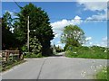
'Leave Kings Road and carry straight on'
On the Kings Road & Easterton Common Walk. See http://www.marketlavington.org.uk/Walks%201.html for more details.
Image: © Christine Johnstone
Taken: 25 May 2014
0.20 miles
9
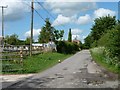
'Straight on ... along Easterton Sands'
On the Kings Road & Easterton Common Walk. See http://www.marketlavington.org.uk/Walks%201.html for more details.
Image: © Christine Johnstone
Taken: 25 May 2014
0.20 miles
10
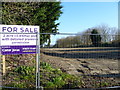
Once a nursery
This plot of land is off Vicarage Lane. There was, until recently, a nursery here with some very large glasshouses. This image makes a dramatic contrast with Rog Frost's image taken in June, 2000 Image
Image: © Michael Dibb
Taken: 3 Dec 2014
0.21 miles