IMAGES TAKEN NEAR TO
Westbury Road, DEVIZES, SN10 4JW

Introduction

This page details the photographs taken nearby to Westbury Road, SN10 4JW by members of the Geograph project.

The Geograph project started in 2005 with the aim of publishing, organising and preserving representative images for every square kilometre of Great Britain, Ireland and the Isle of Man.

There are currently over 7.5m images from over14,400 individuals and you can help contribute to the project by visiting https://www.geograph.org.uk

Image Map


Images are licensed for reuse under creativecommons.org/licenses/by-sa/2.0
Notes
  • Clicking on the map will re-center to the selected point.
  • The higher the marker number, the further away the image location is from the centre of the postcode.

Image Listing (8 Images Found)

Images are licensed for reuse under creativecommons.org/licenses/by-sa/2.0
Image
Details
Distance
1
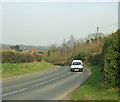
2009 : B3098 west of Little Cheverell
Heading west to Erlestoke, Edington, Bratton and Westbury. Here it is called Westbury Road.
Image: © Maurice Pullin Taken: 17 Mar 2009
0.03 miles
2
Garden gnomes galore! outside house west of Little Cheverell
Image: © David Smith Taken: 1 Jun 2017
0.03 miles
3
2009 : B3098 Westbury Road
A few rooftops of Little Cheverell peer over the hill.
Image: © Maurice Pullin Taken: 17 Mar 2009
0.16 miles
4
Line of trees along Westbury Road, between B3098 and Great Cheverell
Image: © James Harrison Taken: 19 Feb 2011
0.20 miles
5
Lane from Little Cheverell to Great Cheverell
A sunken lane descending to a stream crossing, indicating an easily eroded geology.
Image: © Robin Webster Taken: 21 Aug 2016
0.21 miles
6
Gates to Manor Farm. Little Cheverell
Image: © Chris Henley Taken: 29 Sep 2006
0.21 miles
7
Field by Westbury Road, Cheverell
Image: © David Howard Taken: 5 May 2018
0.22 miles
8
St. Peter, Little Cheverell
A view looking south at the church of St. Peter at Little Cheverell which stands on a bank above the B3098.
Image: © Phil Williams Taken: 28 Jan 2006
0.25 miles