1
Chirton
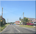
A view west down Small Street which runs through the centre of the residential area of Chirton
Image: © Chris Collard
Taken: 10 Aug 2005
0.05 miles
2
Chirton Residential
A fairly typical scene in the village of Chirton
Image: © Chris Collard
Taken: 10 Aug 2005
0.07 miles
3
Derelict granary, Manor Farm, Chirton
The granary still stands on its staddle stones, see also
Image
Image: © Vieve Forward
Taken: 23 Nov 2019
0.11 miles
4
Derelict granary, Manor Farm, Chirton
The granary still stands on some of its staddle stones, see
Image
Image: © Vieve Forward
Taken: 23 Nov 2019
0.11 miles
5
The Wiltshire Yeoman, Chirton
The pub has recently been refurbished.
Image: © Maigheach-gheal
Taken: 6 Sep 2008
0.14 miles
6
Sign for the Wiltshire Yeoman, Chirton
A Yeoman was a country man or villager. The yeoman was a trusted servant who was more than a knave but less than a squire. He probably had a small estate, such respected farmers who served in the army kept their name, becoming the Yeomanry. Some yeomen were foot soldiers and other cavalry. Yeoman in a pub name may refer to a farmer or a military man, the sign usually making it clear which is meant.
Image: © Maigheach-gheal
Taken: 6 Sep 2008
0.14 miles
7
Milestone, Chirton
Grade II Listed milestone. https://britishlistedbuildings.co.uk/101182164-milestone-at-chirton-crossroads-chirton#.XdmABGdLGUk
Image: © Vieve Forward
Taken: 23 Nov 2019
0.15 miles
8
Old Milestone by the A342, Andover Road, Chirton Parish
Metal plate attached to stone post by the A342, in parish of CHIRTON (KENNET District), Andover Road; Chirton Crossroads, 20m South of Wiltshire Yeoman PH, on cut grass by entrance to factory units, on North side of road. Everleigh iron plate, erected by the Everley turnpike trust in the 19th century.
Inscription reads:-
DEVIZES
5 MILES
EVERLEIGH
9
ANDOVER
21
Grade II listed.
List Entry Number: 1182164 https://historicengland.org.uk/listing/the-list/list-entry/1182164
Milestone Society National ID: WI_DZAV05.
Image: © A Rosevear
Taken: 8 May 2004
0.15 miles
9
A342 passes The Wiltshire Yeoman
Image: © Stuart Logan
Taken: 24 Jul 2014
0.15 miles
10
The A342 enters Chirton
In fact most of the village is off the main road, down a lane to the left.
Image: © Robin Webster
Taken: 17 Mar 2018
0.15 miles


