1
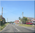
Chirton Residential
A fairly typical scene in the village of Chirton
Image: © Chris Collard
Taken: 10 Aug 2005
0.03 miles
2
Derelict granary, Manor Farm, Chirton
The granary still stands on some of its staddle stones, see
Image
Image: © Vieve Forward
Taken: 23 Nov 2019
0.05 miles
3
Derelict granary, Manor Farm, Chirton
The granary still stands on its staddle stones, see also
Image
Image: © Vieve Forward
Taken: 23 Nov 2019
0.05 miles
4
Chirton Village Hall
Former drill hall for B Squadron Wiltshire Yeomanry.
Image: © John M
Taken: 22 Feb 2015
0.12 miles
5
Chirton Village Hall
Former drill hall for B Squadron Wiltshire Yeomanry.
Image: © John M
Taken: 22 Feb 2015
0.12 miles
6
Chirton houses [8]
Gable Thatch, number 40 The Street, is a 17th century cottage. Timber framed, encased or replaced on the ground floor with cob to the rear, and rubble stone to the front, all under a thatch roof. Originally 2 bays, extended to the south by one bay, and an outbuilding at the north now incorporated. Some original internal features and fittings remain. Listed, grade II, with details at: https://historicengland.org.uk/listing/the-list/list-entry/1284589
Chirton is a village in Wiltshire, on the southern edge of the Vale of Pewsey, about 5 miles southeast of Devizes and some 19 miles northwest of Andover. The name Chirton means 'farm by the Church' and there is still a working farm in the village. Originally an agricultural village, most working residents now commute.
Image: © Michael Dibb
Taken: 7 Apr 2023
0.13 miles
7
Chirton
A view west down Small Street which runs through the centre of the residential area of Chirton
Image: © Chris Collard
Taken: 10 Aug 2005
0.14 miles
8
The A342 enters Chirton
In fact most of the village is off the main road, down a lane to the left.
Image: © Robin Webster
Taken: 17 Mar 2018
0.14 miles
9
A342 passes The Wiltshire Yeoman
Image: © Stuart Logan
Taken: 24 Jul 2014
0.16 miles
10
Chirton houses [7]
Chirton Farmhouse, number 41 The Street, was built in the late 17th or early 18th century and was extended in the 19th century. Constructed of diaper brickwork under a thatch roof. Probably originally 2 bays, timber framed, encased in brick in the 18th century and extended by one bay in the 19th century. Some early internal features and fittings remain. Listed, grade II, with details at: https://historicengland.org.uk/listing/the-list/list-entry/1035811
Chirton is a village in Wiltshire, on the southern edge of the Vale of Pewsey, about 5 miles southeast of Devizes and some 19 miles northwest of Andover. The name Chirton means 'farm by the Church' and there is still a working farm in the village. Originally an agricultural village, most working residents now commute.
Image: © Michael Dibb
Taken: 7 Apr 2023
0.16 miles


![Chirton houses [8]](https://s1.geograph.org.uk/geophotos/07/45/82/7458225_5ff826f2_120x120.jpg)


![Chirton houses [7]](https://s0.geograph.org.uk/geophotos/07/45/82/7458224_75ab51a3_120x120.jpg)