IMAGES TAKEN NEAR TO
Park Road, BANSTEAD, SM7 3ER
Introduction
This page details the photographs taken nearby to Park Road, SM7 3ER by members of the Geograph project.
The Geograph project started in 2005 with the aim of publishing, organising and preserving representative images for every square kilometre of Great Britain, Ireland and the Isle of Man.

There are currently over 7.5m images from over14,400 individuals and you can help contribute to the project by visiting https://www.geograph.org.uk
Image Map
Images are licensed for reuse under creativecommons.org/licenses/by-sa/2.0
Notes
- Clicking on the map will re-center to the selected point.
- The higher the marker number, the further away the image location is from the centre of the postcode.
Image Listing (19 Images Found)
Images are licensed for reuse under creativecommons.org/licenses/by-sa/2.0
Image
Details
Distance
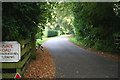
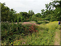
1
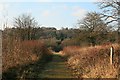
Public Footpath
From Park Road into Park Downs
Image: © The Saunterer
Taken: 29 Jan 2013
0.08 miles
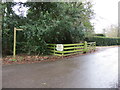
2
Banstead: Soloms Court Road
Looking east. Despite the discouraging notices, you do have the right to walk, cycle, or ride a horse along this road, and moreover there is an exit at the far end.
Image: © Dr Neil Clifton
Taken: 18 Sep 2014
0.08 miles
3
Public Bridleway
Down Soloms Court Road
Image: © The Saunterer
Taken: 29 Jan 2013
0.08 miles
6
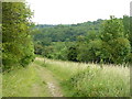
Park Downs, Chipstead
Looking towards the Chipstead Valley.
Image: © Peter Trimming
Taken: 4 Jul 2009
0.11 miles
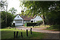
7
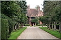
Banstead: Courtlands, Park Road
The owner of this property does not get a free bus pass, as he lives outside the GLC area.
Image: © Dr Neil Clifton
Taken: 18 Sep 2014
0.12 miles
8
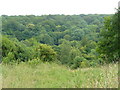
Park Downs, Chipstead
From this picture, it is easy to see why Surrey has the reputation for being the most wooded county in England.
Image: © Peter Trimming
Taken: 4 Jul 2009
0.13 miles
9
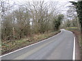
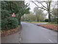
Park Road, near Chipstead
Park Road is a minor road passing through countryside between Banstead and Chipstead, in north Surrey.
Just visible to the left of the image is a wooden signpost indicating the route of a public footpath.
Image: © Malc McDonald
Taken: 11 Jan 2020
0.15 miles
10
Park Downs: view to Banstead Wood
View from Park Downs towards Banstead Wood, on the other side of Holly Lane. Park Down is Metropolitan Common owned by Reigate and Banstead Borough Council, but managed by the Banstead Commons Conservators under the Metropolitan Commons (Banstead) Supplemental Act 1893.
Image: © Hugh Craddock
Taken: 28 Dec 2008
0.15 miles