IMAGES TAKEN NEAR TO
Avenue Road, BANSTEAD, SM7 2PF
Introduction
This page details the photographs taken nearby to Avenue Road, SM7 2PF by members of the Geograph project.
The Geograph project started in 2005 with the aim of publishing, organising and preserving representative images for every square kilometre of Great Britain, Ireland and the Isle of Man.

There are currently over 7.5m images from over14,400 individuals and you can help contribute to the project by visiting https://www.geograph.org.uk
Image Map (Loading...)


Getting Data...Please wait
Leaflet Map data © OpenStreetMap
Images are licensed for reuse under creativecommons.org/licenses/by-sa/2.0
Notes
- Clicking on the map will re-center to the selected point.
- The higher the marker number, the further away the image location is from the centre of the postcode.
Image Listing (116 Images Found)
Images are licensed for reuse under creativecommons.org/licenses/by-sa/2.0
Image
Details
Distance
2
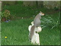
Squirrel in Banstead church yard
A squirrel finds a convenient spot to view the world
Image: © Henry Spooner
Taken: 20 Apr 2009
0.08 miles
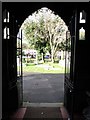
3
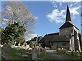
All Saints, Banstead: mid February 2018
Image: © Basher Eyre
Taken: 15 Feb 2018
0.09 miles
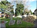
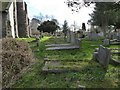
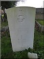
7
All Saints, Banstead: churchyard (d)
Also see https://www.cwgc.org/find-war-dead/casualty/2433829/stanley,-leslie-albert/
Image: © Basher Eyre
Taken: 15 Feb 2018
0.09 miles
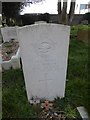
8
All Saints, Banstead: churchyard (e)
Also see https://www.cwgc.org/find-war-dead/casualty/2433827/lintott,-john-peter-marley/
Image: © Basher Eyre
Taken: 15 Feb 2018
0.09 miles
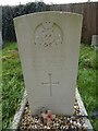
9
All Saints, Banstead: churchyard (f)
Also see https://www.cwgc.org/find-war-dead/casualty/2433824/hobson,-colin-anthony/
Image: © Basher Eyre
Taken: 15 Feb 2018
0.09 miles
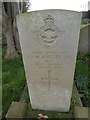
10
All Saints, Banstead: churchyard (g)
Also see https://www.cwgc.org/find-war-dead/casualty/2433831/williams,-montagu-norminton/
Image: © Basher Eyre
Taken: 15 Feb 2018
0.09 miles