IMAGES TAKEN NEAR TO
Garratts Lane, BANSTEAD, SM7 2EF
Introduction
This page details the photographs taken nearby to Garratts Lane, SM7 2EF by members of the Geograph project.
The Geograph project started in 2005 with the aim of publishing, organising and preserving representative images for every square kilometre of Great Britain, Ireland and the Isle of Man.

There are currently over 7.5m images from over14,400 individuals and you can help contribute to the project by visiting https://www.geograph.org.uk
Image Map (Loading...)


Getting Data...Please wait
Leaflet Map data © OpenStreetMap
Images are licensed for reuse under creativecommons.org/licenses/by-sa/2.0
Notes
- Clicking on the map will re-center to the selected point.
- The higher the marker number, the further away the image location is from the centre of the postcode.
Image Listing (11 Images Found)
Images are licensed for reuse under creativecommons.org/licenses/by-sa/2.0
Image
Details
Distance
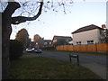
3
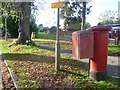
Banstead: Garratts Lane, at the end of Garrard Road
Image: © Dr Neil Clifton
Taken: 24 Sep 2014
0.10 miles
4
View from The Drive, Banstead
This is close to the junction with Brighton Road (A217) and looks towards the road called Woodgavil.
Image: © Marathon
Taken: 4 Nov 2013
0.12 miles
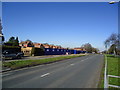
5
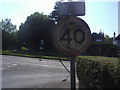
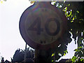
Pre-Worboys speed limit, Ferndale Road Banstead
Image: © David Howard
Taken: 24 May 2009
0.13 miles
6
Pre-Worboys speed limit, Ferndale Road Banstead
Image: © David Howard
Taken: 24 May 2009
0.13 miles
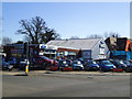
7
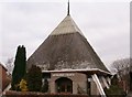
Banstead, Surrey
This unusual building is the Banstead Methodist Church. The majority of this square is taken up with residential housing estates and the main A217 main road.
Image: © Brendan and Ruth McCartney
Taken: 2 Feb 2005
0.15 miles
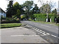
8
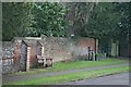
Village pump and bench
Pump, water trough and bench on a small patch of roadside verge on a bend in Garratts Lane. The backdrop of the C19 listed boundary wall of 19 Garratts Lane ('Little Garratts') (the entrance to which is beyond the trough) is evocative of an earlier age. The pump is a replacement, following accidental damage in 2000-01. Compare with this historical postcard: http://www.bansteadhistory.com/Garratts_pump_300179.jpg
Image: © Hugh Craddock
Taken: 27 Dec 2013
0.17 miles
9
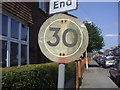
Pre-Worboys speed limit, Lyme Regis Road Banstead
Image: © David Howard
Taken: 24 May 2009
0.19 miles