
IMAGES TAKEN NEAR TO
Villiers Grove, SUTTON, SM2 7NN
Introduction
This page details the photographs taken nearby to Villiers Grove, SM2 7NN by members of the Geograph project.
The Geograph project started in 2005 with the aim of publishing, organising and preserving representative images for every square kilometre of Great Britain, Ireland and the Isle of Man.

There are currently over 7.5m images from over14,400 individuals and you can help contribute to the project by visiting https://www.geograph.org.uk
Image Map
Images are licensed for reuse under creativecommons.org/licenses/by-sa/2.0
Notes
- Clicking on the map will re-center to the selected point.
- The higher the marker number, the further away the image location is from the centre of the postcode.
Image Listing (9 Images Found)
Images are licensed for reuse under creativecommons.org/licenses/by-sa/2.0
Image
Details
Distance
1
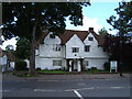
Whitehall, Cheam
http://www.friendsofwhitehallcheam.co.uk/
Image: © Roger Miller
Taken: 3 Aug 2005
0.15 miles
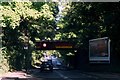
3

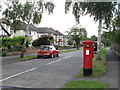
Edward VIII postbox, Merrow Road / Ranmore Road
Image: © Mike Quinn
Taken: 20 Aug 2008
0.17 miles
4
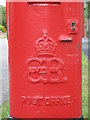
Edward VIII postbox, Merrow Road / Ranmore Road - royal cipher
See Image
Image: © Mike Quinn
Taken: 20 Aug 2008
0.17 miles
5
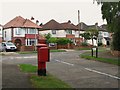
Merrow Road / Ranmore Road
Shows the location of Image
Image: © Mike Quinn
Taken: 20 Aug 2008
0.18 miles
7
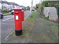
Cheam: postbox № SM2 260, Merrow Road
One of few pillar boxes to be cast during the short reign of Edward VIII - there are 80 or so still in use. This one is on the corner of Merrow and Ranmore Roads and is emptied finally at 6:15pm on weekdays and at 11:45am on Saturdays.
See Image for a close-up of the cipher.
Image: © Chris Downer
Taken: 18 Jan 2014
0.19 miles
8

Entrance to Nonsuch High School for Girls
Image: © Roger Miller
Taken: 19 Oct 2008
0.24 miles
9
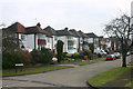
Bramley Road, Cheam
Taken from beneath the railway bridge shown on one of the Geographs for this square.
Image: © David Kemp
Taken: 14 Feb 2009
0.24 miles