IMAGES TAKEN NEAR TO
Harefield Avenue, SUTTON, SM2 7ND
Introduction
This page details the photographs taken nearby to Harefield Avenue, SM2 7ND by members of the Geograph project.
The Geograph project started in 2005 with the aim of publishing, organising and preserving representative images for every square kilometre of Great Britain, Ireland and the Isle of Man.

There are currently over 7.5m images from over14,400 individuals and you can help contribute to the project by visiting https://www.geograph.org.uk
Image Map
Images are licensed for reuse under creativecommons.org/licenses/by-sa/2.0
Notes
- Clicking on the map will re-center to the selected point.
- The higher the marker number, the further away the image location is from the centre of the postcode.
Image Listing (10 Images Found)
Images are licensed for reuse under creativecommons.org/licenses/by-sa/2.0
Image
Details
Distance
1
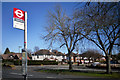
Bramley Road Bus Stop
The London Loop path gets to Cheam Road here and then very properly is signposted beside this busy route for a while so as to go over at a controlled crossing place quite a way further along.
But if you cross over here anyway and go down Hays Walk, the road opposite, you cut a bit out of this rather long roadside section between Nonsuch Park and Banstead Downs.
Image: © Des Blenkinsopp
Taken: 26 Mar 2012
0.15 miles
2
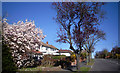
Northey Avenue
Between Nonsuch Park and Banstead Downs the London Loop Path has to go roadside for about 2km as there are no linking footpaths.
But the streets are quiet residential ones like Northey Ave. here, and on a day like this with all the spring stuff coming out it's very pleasant.
Image: © Des Blenkinsopp
Taken: 26 Mar 2012
0.17 miles
3
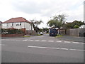
Hays Walk at the junction of Northey Avenue
Image: © David Howard
Taken: 1 Jun 2014
0.18 miles
4
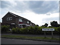
Houses on Cheyham Way, Belmont
These are typical 1960s small semis
Image: © David Howard
Taken: 1 Jun 2014
0.21 miles
5
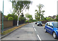
Ewell East: Cheyham Way
From Northey Avenue
Image: © Dr Neil Clifton
Taken: 27 Jul 2013
0.22 miles
6
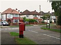
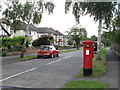
Merrow Road / Ranmore Road
Shows the location of Image
Image: © Mike Quinn
Taken: 20 Aug 2008
0.23 miles
7

Edward VIII postbox, Merrow Road / Ranmore Road
Image: © Mike Quinn
Taken: 20 Aug 2008
0.24 miles
8
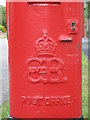
Edward VIII postbox, Merrow Road / Ranmore Road - royal cipher
See Image
Image: © Mike Quinn
Taken: 20 Aug 2008
0.24 miles
9
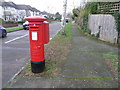
Cheam: postbox № SM2 260, Merrow Road
One of few pillar boxes to be cast during the short reign of Edward VIII - there are 80 or so still in use. This one is on the corner of Merrow and Ranmore Roads and is emptied finally at 6:15pm on weekdays and at 11:45am on Saturdays.
See Image for a close-up of the cipher.
Image: © Chris Downer
Taken: 18 Jan 2014
0.24 miles