IMAGES TAKEN NEAR TO
Austenwood Lane, GERRARDS CROSS, SL9 9DF

Introduction

This page details the photographs taken nearby to Austenwood Lane, SL9 9DF by members of the Geograph project.

The Geograph project started in 2005 with the aim of publishing, organising and preserving representative images for every square kilometre of Great Britain, Ireland and the Isle of Man.

There are currently over 7.5m images from over14,400 individuals and you can help contribute to the project by visiting https://www.geograph.org.uk

Image Map


Images are licensed for reuse under creativecommons.org/licenses/by-sa/2.0
Notes
  • Clicking on the map will re-center to the selected point.
  • The higher the marker number, the further away the image location is from the centre of the postcode.

Image Listing (18 Images Found)

Images are licensed for reuse under creativecommons.org/licenses/by-sa/2.0
Image
Details
Distance
1
Austenwood Lane, Chalfont St Peter
Image: © David Howard Taken: 28 Feb 2013
0.01 miles
2
Elizabeth II postbox, Gold Hill Baptist Church
Gold Hill East, Chalfont St Peter. Postbox No. SL9 106. See Image] for close up. See Image] for context.
Image: © JThomas Taken: 13 Apr 2019
0.03 miles
3
Elizabeth II postbox, Gold Hill Baptist Church
Gold Hill East, Chalfont St Peter. Postbox No. SL9 106. See Image] for wider view. See Image] for context.
Image: © JThomas Taken: 13 Apr 2019
0.03 miles
4
The Village Hall, Goldhill Common
A misleading name, as it is a pub and grill.
Image: © Robin Webster Taken: 18 Jun 2016
0.03 miles
5
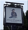
Sign for the Jolly Farmer, Chalfont St Peter
Image: © JThomas Taken: 13 Apr 2019
0.03 miles
6
The Jolly Farmer, Chalfont St Peter
Image: © JThomas Taken: 13 Apr 2019
0.03 miles
7
Gold Hill Baptist Church
Showing position of Postbox No. SL9 106. See Image] for postbox.
Image: © JThomas Taken: 13 Apr 2019
0.03 miles
8
Former Gold Hill Baptist Church, Bucks
Situated in Gold Hill East, Chalfont St Peter, this Church dates from 1871, although there had been a Baptist Church on this site since 1792. Its postcode is SL9 9DG. Update; this Church has now moved to Chapel Lane, Chalfont St Peter, SL9 9RF, SU9990 refers.
Image: © David Hillas Taken: 20 May 2009
0.05 miles
9
Heritage Plaque in Gold Hill West
This plaque is located on the north side of a bus shelter in Gold Hill West. It is one of several on the Celfunde Inheritance Heritage Walk and has an image of the original Gold Hill Baptist Church. The wording below it is as follows: Gold Hill Baptist Church. Built in 1792 by Thomas Keen after a public appeal for funds, it was replaced in 1870 by the current building.
Image: © David Hillas Taken: 18 Oct 2024
0.06 miles
10
Goldhill Common
Viewed from the entrance to Holy Cross Convent School where the common climbs up, out of the centre of Chalfont St Peter, to higher ground above.
Image: © David Squire Taken: 5 Dec 2005
0.11 miles