IMAGES TAKEN NEAR TO
North Park, GERRARDS CROSS, SL9 8JR
Introduction
This page details the photographs taken nearby to North Park, SL9 8JR by members of the Geograph project.
The Geograph project started in 2005 with the aim of publishing, organising and preserving representative images for every square kilometre of Great Britain, Ireland and the Isle of Man.

There are currently over 7.5m images from over14,400 individuals and you can help contribute to the project by visiting https://www.geograph.org.uk
Image Map
Images are licensed for reuse under creativecommons.org/licenses/by-sa/2.0
Notes
- Clicking on the map will re-center to the selected point.
- The higher the marker number, the further away the image location is from the centre of the postcode.
Image Listing (23 Images Found)
Images are licensed for reuse under creativecommons.org/licenses/by-sa/2.0
Image
Details
Distance
1
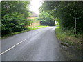
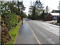
Footpaths off Amersham Road
Footpaths off Amersham Road to the right it heads down to A413 Amersham Road
Image: © Shaun Ferguson
Taken: 7 Aug 2009
0.13 miles
3
Packhorse Road, Gerrards Cross
Looking south east on the B416.
Image: © JThomas
Taken: 13 Apr 2019
0.18 miles
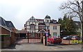
4
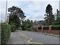
Looking across Oval Way towards Thorpe House School
Image: © Basher Eyre
Taken: 13 Aug 2016
0.20 miles
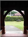
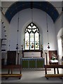
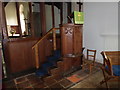
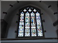
6
All Saints, Oval Way: stained glass window (3)
Image: © Basher Eyre
Taken: 13 Aug 2016
0.22 miles
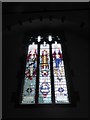
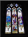
7
All Saints, Oval Way: stained glass window (2)
Image: © Basher Eyre
Taken: 13 Aug 2016
0.22 miles
8
All Saints, Oval Way: stained glass window (1)
Image: © Basher Eyre
Taken: 13 Aug 2016
0.22 miles