IMAGES TAKEN NEAR TO
Honey Lane, MAIDENHEAD, SL6 6RB
Introduction
This page details the photographs taken nearby to Honey Lane, SL6 6RB by members of the Geograph project.
The Geograph project started in 2005 with the aim of publishing, organising and preserving representative images for every square kilometre of Great Britain, Ireland and the Isle of Man.

There are currently over 7.5m images from over14,400 individuals and you can help contribute to the project by visiting https://www.geograph.org.uk
Image Map
Images are licensed for reuse under creativecommons.org/licenses/by-sa/2.0
Notes
- Clicking on the map will re-center to the selected point.
- The higher the marker number, the further away the image location is from the centre of the postcode.
Image Listing (11 Images Found)
Images are licensed for reuse under creativecommons.org/licenses/by-sa/2.0
Image
Details
Distance
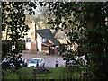
3
Beech wood, Ashley Hill
The summit of the hill is now adorned with a posh residence. In my youth there was just derelict keeper's cottage.
Image: © Andrew Smith
Taken: 17 Nov 2005
0.15 miles
4
Ashley Hill
On the northern side, looking down to Honey Lane.
Image: © Andrew Smith
Taken: 2 Dec 2006
0.15 miles
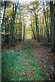
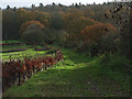
5
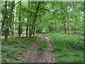
Footpath heading up Ashley Hill
Off Honey Lane the Footpath heading up Ashley Hill
Image: © Shaun Ferguson
Taken: 12 Jun 2009
0.16 miles
6
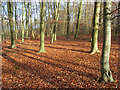
Beeches on Ashley Hill
An area of fairly young trees just to the east of the top of the hill. Ashley Hill Forest consists of a mixture of woodland types.
Image: © Andrew Smith
Taken: 20 Nov 2008
0.16 miles
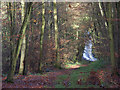
8
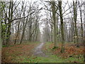
Path at Ashley Hill
The path descends sharply down the side of Ashley Hill
Image: © don cload
Taken: 11 Apr 2009
0.17 miles
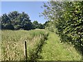
9
Bridleway near Top Farm
Leading southwards towards the flank of Ashley Hill.
Image: © Andrew Smith
Taken: 2 Dec 2006
0.17 miles
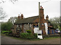
10
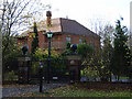
Clifton, Ashley Hill
New house which replaced a derelict keeper's cottage. The highest point of east Berkshire - only 475 feet.
Image: © Andrew Smith
Taken: 2 Dec 2006
0.21 miles